Business Details
50+ Years
experience
Emergency
services
Your Trusted Partner for Engineering & Surveying Solutions
Rowe Surveying & Engrg has been a trusted provider of civil engineering and surveying services since 1954. Our team of professional engineers and land surveyors delivers comprehensive solutions for land development, infrastructure projects, and environmental restoration across the Gulf Coast and Southeast U.S. We specialize in boundary surveys, hydrographic mapping, aerial data collection, and complex engineering designs for residential, commercial, and municipal clients. With over 65 years of experience, we combine advanced technology with traditional expertise to meet project requirements. Our services include topographic surveys, construction stakeout, flood studies, and environmental compliance solutions.We maintain a client-focused approach, ensuring precise execution of cadastral surveys, ALTA/NSPS standards, and RTK/GPS applications. Our hydrographic capabilities extend to single-beam and multi-beam bathymetry for coastal and inland water projects. As a FAA-certified drone operator, we integrate aerial mapping with traditional survey methods. Our engineering team manages full project lifecycles from initial planning to construction administration. We pride ourselves on delivering cost-efficient, quality-driven results that exceed client expectations while maintaining uncompromising attention to detail.
Services
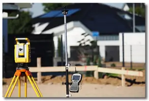
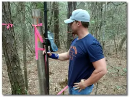
Land Surveying
Hydrographic Surveying
Engineering Services
Aerial Mapping
Boundary Surveys
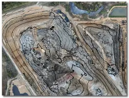
Topographic Surveys
Construction Stakeout
Flood Studies
Details
- Year established: 1954
Highlights and features
- We offer 65+ years of combined experience in civil engineering and surveying
- Our FAA-certified drone pilots provide advanced aerial mapping capabilities
- We handle complex projects from small lot surveys to statewide inventories
- Our team includes specialists in RTK/GPS and multi-beam bathymetry technologies
- We maintain 24/7 emergency response capabilities for critical infrastructure projects
Services
Land Surveying
Our land surveying services include boundary determination, topographic mapping, and construction stakeout using RTK/GPS technology. We provide ALTA/NSPS standards compliance and metes-and-bounds surveys for residential and commercial properties. Our team interprets legal descriptions and physical evidence to resolve boundary disputes while maintaining precise documentation for legal records.
Hydrographic Surveying
We conduct hydrographic surveys using single-beam and multi-beam bathymetry systems to map underwater elevations. Our services include channel condition assessments, dredge monitoring, and pipeline location for coastal and inland water projects. We combine traditional survey methods with drone-based aerial photography to create comprehensive underwater topographic models for environmental restoration and infrastructure planning.
Engineering Services
Our civil engineering team manages residential and commercial development projects from planning to construction. We specialize in stormwater management systems, roadway infrastructure, and utility main improvements. Our services include FEMA flood map revisions, water surface profile analysis, and low-impact development solutions that integrate with natural coastal environments while meeting municipal permitting requirements.
Aerial Mapping
As FAA-certified drone operators, we provide aerial mapping services using Trimble UX5 Survey Drones. Our capabilities include 3D modeling, vegetation surveys, and construction progress monitoring. We combine drone-collected georeferenced data with traditional survey methods to create accurate as-built documentation and volumetric calculations for large-scale development projects.
Flood Studies
We conduct comprehensive flood studies using advanced hydraulic modeling software to analyze existing city systems and develop flood mitigation strategies. Our services include FEMA flood map revisions, water surface profile analysis, and stormwater management planning. We help clients obtain Letters of Map Revision (LOMR/CLOMR) while ensuring compliance with environmental regulations for coastal and urban development projects.
People
Cecil Zeke Hudson
President
With over 30 years of surveying experience, Zeke Hudson oversees all surveying operations at Rowe Surveying & Engrg. A FAA-certified drone pilot and licensed land surveyor, he specializes in boundary resolution, topographic mapping, and hydrographic surveys while maintaining active membership in multiple professional surveying organizations.
Jackson Berkbigler
Principal Engineer
Jackson Berkbigler leads civil engineering projects with expertise in land development and infrastructure design. He manages commercial and residential subdivisions, roadway improvements, and utility systems while ensuring compliance with state and federal regulations through comprehensive permitting processes and field inspections.
Andrew Hodges
Engineer Intern
Andrew Hodges applies his civil engineering expertise to RV park developments, subdivisions, and commercial projects. He focuses on grading and drainage solutions, roadway design, and engineering drafting while gaining experience across various project phases from initial planning to construction documentation.
Questions
What engineering services do you offer?
We provide civil engineering services for residential and commercial developments, including site planning, stormwater management, roadway infrastructure, and utility system design across the Gulf Coast region.
How long have you been in business?
Rowe Engineering & Surveying has served clients since 1954, maintaining expertise in civil engineering and surveying services for over 65 years across the Southeast United States.
Do you handle emergency surveying projects?
Yes, we provide 24/7 emergency response capabilities, as demonstrated during Hurricane Katrina recovery efforts when we reopened the Pascagoula River Ship Channel through urgent hydrographic surveys.
What areas do you serve?
We primarily serve the Gulf Coast and Southeast United States, with extensive experience in Mobile, Alabama and Mississippi coastal regions for engineering and surveying projects.
What sets you apart from competitors?
Our combination of 65+ years experience, FAA-certified drone operations, and specialized hydrographic survey capabilities enables comprehensive solutions from small lot surveys to large-scale infrastructure projects.