Business Details
Emergency
services
Professional Land Surveying Services in Boise, ID
Accurate Surveying & Mapping has been delivering precise and reliable land surveying solutions in Boise, Idaho, and surrounding regions since our founding. Our team of licensed professionals specializes in boundary surveys, topographic mapping, ALTA/NSPS standards compliance, and advanced aerial imaging tailored to meet diverse project requirements. With decades of combined experience, we prioritize accuracy, efficiency, and client collaboration to ensure every project aligns with legal, engineering, and development needs. Our commitment to leveraging cutting-edge technology and maintaining open communication sets us apart in the industry.Whether supporting residential landowners or commercial developers, we approach every task with meticulous attention to detail. Our reputation for timely execution and transparent service has made us a trusted partner for complex surveying challenges across Southwest Idaho and beyond. By focusing on continuous professional development and adherence to state and national standards, we guarantee results that meet the highest benchmarks of quality and reliability.
Services
Boundary Surveys
Topographic Mapping
ALTA/NSPS Surveys
Aerial Imaging
Construction Staking
Land Descriptions
Boundary Adjustments
Tower Lease Surveys
As-Built Surveys
Control Surveys
Highlights and features
- Licensed surveyors with decades of local expertise in Southwest Idaho
- Comprehensive services from boundary surveys to aerial mapping
- Commitment to timely execution and transparent communication
- Customized solutions for residential, commercial, and legal needs
- Adherence to ALTA/NSPS and state surveying standards
Services
Boundary Surveys
We establish and verify property boundaries and corners using advanced equipment and legal records. Our surveys ensure compliance with local regulations and resolve disputes. Clients receive detailed documentation for real estate transactions or development planning.
Topographic Mapping
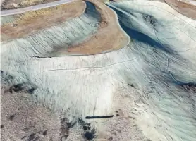
We create detailed elevation maps showing natural and man-made features. This data supports construction, drainage planning, and environmental assessments. Our surveys integrate with engineering designs for accurate land development.
ALTA/NSPS Surveys
We conduct ALTA/NSPS-compliant surveys for commercial properties, including title, easements, and improvements. These surveys meet lender and legal requirements for transactions. Clients gain comprehensive site inventories with standardized reporting.
Aerial Imaging
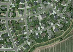
We use drones to capture high-resolution aerial imagery for site analysis and planning. This technology provides cost-effective, large-scale data collection. Clients receive georeferenced maps for construction, agriculture, or environmental monitoring.
Construction Staking
We mark precise locations for buildings, roads, and utilities based on engineering plans. Our staking ensures projects adhere to design specifications. Clients benefit from reduced errors and streamlined construction timelines.
People
Nathan J. Dang
Principal/Professional Land Surveyor
Nathan leads our team with expertise in land surveying standards and project management. He ensures all work meets legal and technical requirements while maintaining client-focused solutions for complex developments.
Jack Clark
Professional Land Surveyor
Jack specializes in boundary resolution and ALTA surveys, bringing precision to commercial and residential projects. His attention to detail ensures compliance with state regulations and client expectations across diverse terrains.
Brandon Grant
Survey Technician
Brandon supports field operations with hands-on expertise in data collection and equipment operation. He assists in delivering accurate measurements and timely results for boundary, topographic, and construction surveys.
Steve Rogers
Survey Technician
Steve contributes to fieldwork and mapping tasks, ensuring efficient data gathering for land development projects. His technical skills support the team in meeting deadlines without compromising accuracy.
Trotsky
The Boss
Trotsky oversees operations with a focus on quality control and team coordination. His leadership ensures seamless project execution from initial surveys to final deliverables for satisfied clients.
Questions
What surveying services do you offer?
We provide boundary surveys, topographic mapping, ALTA/NSPS surveys, aerial imaging, construction staking, and land descriptions tailored to residential and commercial needs.
Do you serve areas outside Boise?
Yes, we operate throughout Southwest Idaho and beyond, adapting to regional land development and surveying requirements.
How can I request a proposal?
Fill out our online form or call us at (208) 488-4227 to discuss your project details and receive a customized proposal.
Are your surveyors licensed?
Yes, our team includes licensed professionals like Nathan J. Dang and Jack Clark, adhering to state and national standards.
Can you handle urgent projects?
We prioritize timely execution and accommodate last-minute requests while maintaining precision and compliance.