Business Details
23 Years
experience
Professional Aerial Photography Services in Texas
Red Wing Aerial Photography has been delivering professional aerial, drone, and ground photography services across Texas for over two decades. Founded in 2003, our company combines extensive industry experience with cutting-edge technology to meet the evolving needs of commercial real estate, construction, energy, and maritime clients. Our team of FAA-certified drone operators and licensed pilots specializes in capturing high-resolution imagery from multiple platforms, including drones, helicopters, and airplanes. With daily flights covering major Texas markets and surrounding regions, we provide tailored solutions that highlight property features, construction progress, and locational advantages.Our commitment to quality is evidenced by our international award-winning work and partnerships with leading real estate firms. We maintain offices in San Antonio, Dallas, Houston, and McAllen, ensuring responsive service across Texas. Our vertically integrated approach allows clients to combine ground photography with aerial perspectives in a single project, streamlining marketing and documentation processes. Backed by 20+ years of industry expertise and a stock photo library of 142,000+ images, we offer both custom shoots and immediate solutions for time-sensitive projects.
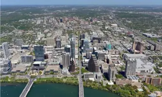
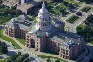
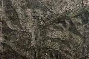
Services
Aerial Photography
Drone Videography
Architectural Photography
Construction Documentation
Energy Sector Imaging
Maritime Photography
Vertical Mapping
Stock Imagery
Event Coverage
Custom Packages
Details
- Year established: 2003
Highlights and features
- 20+ years serving commercial real estate and construction industries
- FAA-certified drone operators with manned aircraft capabilities
- Comprehensive ground and aerial photography integration
- Award-winning imagery from international aerial photography competitions
- Daily flights covering all major Texas markets
Associations and certifications
- FAA Part 107 certified
What people say
Photos look great
Prompt service
Attention to detail
Professional team
Excellent results
Services
Aerial Photography
Our aerial photography services capture comprehensive property views using manned aircraft platforms. This service provides high-altitude perspectives showing locational advantages and surrounding context. Ideal for real estate marketing and infrastructure documentation, our FAA-certified pilots and photographers deliver 36-megapixel resolution imagery suitable for both print and digital applications.
Drone Videography
Professional drone videography services offer dynamic low-altitude footage with cinematic quality. Our Part 107-certified operators use DJI and Autel drones to capture 4K video for property showcases and construction documentation. This service provides unique perspectives unattainable from traditional aircraft due to FAA altitude restrictions and airport proximity limitations.
Architectural Photography
Comprehensive architectural photography services document buildings and properties from ground level. Our photographers specialize in commercial real estate, capturing both interior and exterior features for marketing materials. This service includes elevated ground shots that show parking capacity and customer traffic patterns for retail properties.
Construction Documentation
Specialized construction progress photography tracks development timelines using consistent imaging techniques. Available as standalone service or with aerial components, this offering includes print and digital deliverables in multiple formats. Our team provides regular documentation cycles to showcase project milestones to stakeholders and investors.
Vertical Mapping
High-resolution vertical mapping services create precise 'map-like' imagery using specialized camera equipment. This service produces georeferenced orthophotos with 6-inch resolution, suitable for land surveys and planning documents. Available in TIFF and JPEG formats, these images support large-format printing for presentation purposes.
People
Kevin Butts
President
With over 20 years in aerial photography, Kevin leads Red Wing Aerial Photography' technical operations and quality control. His expertise in FAA regulations and aerial imaging techniques ensures compliance and innovation across all projects.
Questions
What areas in Texas do you service?
We cover all major Texas markets including San Antonio, Austin, Dallas, Houston, Corpus Christi, McAllen, Midland, and surrounding regions with daily flight availability.
What photography platforms do you use?
We utilize drones (up to 400' altitude), helicopters (400'-1,000'), and airplanes (1,000'+) to provide comprehensive imaging solutions tailored to each project's requirements.
How quickly can you complete a project?
Most standard projects deliver within 48 hours of capture, with urgent requests accommodated through our priority scheduling system for time-sensitive needs.
Do you offer stock photo options?
Yes, our library contains over 142,000 stock aerial images available from $10 per image, with complete location galleries offering significant cost savings compared to custom shoots.
What formats do you provide images in?
We deliver images electronically via download links, with optional CD/DVD delivery. File formats include high-resolution JPEG and TIFF, with commercial print quality 36-megapixel options available.
Are your drone operators certified?
All drone operations are conducted by FAA Part 107-certified pilots with extensive experience in commercial applications and airspace compliance requirements.
Videos