Business Details
28 Years
experience
Emergency
services
Ground Penetrating Radar Services
GPR Data has been a leader in ground penetrating radar technology since 1998, delivering precise subsurface data for concrete and earth investigations. Our team combines decades of technical expertise with state-of-the-art equipment to provide non-destructive testing solutions for complex projects nationwide. We specialize in 2D and 3D imaging, offering services such as subsurface utility mapping, bridge deck assessments, and environmental surveys. With offices in Oregon, Nevada, Washington, California, and Alaska, we serve diverse industries including construction, infrastructure, and environmental sectors. Our commitment to innovation is demonstrated through proprietary 3D digital processing techniques and patented data collection methods. We maintain rapid response times and prioritize client collaboration, ensuring tailored solutions that meet specific project requirements.Our licensed professionals have accumulated over 30 years of field experience, supporting clients with accurate data interpretation and actionable recommendations. We adhere to strict quality standards, utilizing advanced technologies like full-resolution microwave radar and infrared thermography. Our services reduce project risks by identifying subsurface hazards before excavation or construction begins. We maintain transparency in operations, providing detailed reports with georeferenced data deliverables. Our track record includes high-profile projects for government agencies, engineering firms, and private enterprises across North America.
Services
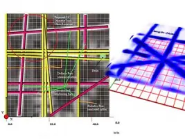
Subsurface Utility Locating
Bridge Deck Inspections
Concrete Imaging
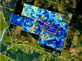
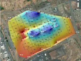
Environmental Mapping
Pipeline Inspections
Void Detection
As-Built Documentation
Pavement Analysis
Archaeological Surveys
Details
- Year established: 1998
Highlights and features
- We offer 30+ years of specialized GPR data collection and analysis experience
- Our patented 3D data processing delivers high-resolution subsurface imaging
- We operate nationwide with rapid deployment capabilities
- Our non-destructive methods preserve structural integrity during inspections
- We integrate multiple technologies for comprehensive subsurface assessments
What people say
Easy to work with
Provided relevant results
Saved a bunch of money
Perfect results
Highly recommend
Services
Subsurface Utility Locating
Our subsurface utility locating service identifies buried infrastructure using ground penetrating radar technology. We map gas, water, electric, and fiber optic lines to depths of 30 meters, providing accurate XYZ coordinates for safe excavation planning. This non-destructive method reduces project risks by preventing accidental utility strikes during construction activities.
Bridge Deck Inspections
Bridge deck inspections combine GPR and infrared thermography to evaluate concrete condition. We detect delamination, rebar corrosion, and structural weaknesses at highway speeds without lane closures. Our comprehensive reports include deterioration mapping and overlay thickness measurements to support maintenance planning for transportation agencies.
Concrete Imaging
Concrete imaging services visualize embedded elements in structural concrete. We map rebar, post-tension cables, and voids in slabs, walls, and columns. This non-invasive technique ensures safe core drilling and saw cutting operations while maintaining structural integrity during renovations or repairs.
Environmental Mapping
Environmental mapping services identify subsurface features for remediation projects. Our GPR systems detect bedrock depth, contaminant plumes, landfill boundaries, and abandoned mine shafts. This technology supports environmental assessments and land development projects requiring detailed subsurface information.
Pipeline Inspections
Pipeline inspection services locate leaks and structural defects in buried pipelines. Using multi-sensor technology, we identify problem areas in concrete, steel, and plastic piping systems. Our depth-accurate mapping supports maintenance planning for water, sewer, and industrial pipeline networks.
People
Matthew Edwards
President
Matthew Edwards leads GPR Data as President and Chief Geophysicist. With over 25 years in the field, he oversees technical operations and client relationships, specializing in complex problem resolution and engineered solutions for subsurface investigations.
Nathan Rasnick
General Manager - Las Vegas
Nathan Rasnick manages GPR Data's Las Vegas operations with 15 years of geophysics experience. His expertise in field applications and subsurface utility mapping supports complex projects across the southwestern United States.
Casey Coyle
General Manager - Eugene
Casey Coyle serves as staff geologist and Eugene office manager. With extensive geological expertise, he provides technical leadership for Pacific Northwest projects requiring precise subsurface data interpretation and analysis.
Tad Letzring
Field Engineer - Seattle
Tad Letzring brings 15+ years of utility mapping experience to GPR Data's Seattle operations. His expertise in subsurface infrastructure surveying supports transportation and municipal projects throughout the Pacific Northwest.
Rich McDade
Field Technician - Las Vegas
Rich McDade specializes in utility and concrete inspections for GPR Data's Las Vegas team. His extensive field experience includes utility construction inspections and advanced subsurface mapping techniques for complex infrastructure projects.
Questions
What subsurface features can GPR detect?
Our ground penetrating radar systems identify utilities, voids, rebar, bedrock, contaminant plumes, and structural defects to depths of 30 meters in most conditions.
How does GPR concrete scanning work?
GPR emits electromagnetic pulses that reflect from objects within concrete structures, creating detailed 3D maps of embedded elements without damaging the material.
Can you inspect bridge decks at highway speeds?
Yes, our high-speed data collection systems perform bridge deck assessments without lane closures using vehicle-mounted radar and infrared equipment.
Do you provide nationwide service?
We operate across North America with offices in Oregon, Nevada, Washington, California, and Alaska, supporting projects of any scale.
What data formats do you deliver?
We provide CAD/GIS files, 3D models, and comprehensive reports with georeferenced data for seamless integration into engineering workflows.