
Business Details
37 Years
experience
Emergency
services
Professional Land Surveying Services in San Francisco
Meridian Surveying Engineering has been a trusted provider of professional land surveying services since 1989. Our team of experienced surveyors and engineers delivers precise, scalable solutions for commercial, residential, municipal, and industrial clients across California and the San Francisco Bay Area. With advanced technologies like HD 3D laser scanning, hydrographic surveying, and drone mapping, we combine decades of expertise with cutting-edge tools to ensure accuracy and efficiency. Our staff holds specialized qualifications in GIS, GPS, and civil engineering, supported by a proven track record with high-profile clients like Apple, Parsons, and CalTrans. We maintain industry-leading accreditations, including CA State Certified Small Business Enterprise (SBE) and City of San Francisco Certified Local Business Enterprise (LBE) status.Our commitment to continuous improvement drives innovative approaches like our StabiAlert real-time settlement monitoring system. With offices strategically located in San Francisco, San Rafael, Santa Rosa, and Antioch, we provide rapid response capabilities for time-sensitive projects. Our principal, Stanley T. Gray, PLS, offers expert witness services and litigation support with over 30 years of experience in boundary disputes and accident scene analysis. We prioritize client satisfaction through transparent communication, competitive pricing, and adherence to strict quality assurance standards.
Services
Commercial Surveying
Residential Surveying
FEMA Elevation Certificates
Hydrographic Surveys
3D Laser Scanning
Settlement Monitoring
Expert Witness Services
ALTA Surveys
Drone Mapping
ADA Compliance Surveys
Details
- Year established: 1989
Highlights and features
- 30+ years of experience in land surveying and civil engineering
- State-of-the-art equipment for HD 3D scanning and drone surveys
- Expert witness services with litigation support expertise
- Multiple Bay Area offices for rapid project mobilization
- Certified SBE/LBE status meeting local government contracting requirements
Associations and certifications
- Board for Professional Engineers and Land Surveyors
- CA State Certified Small Business Enterprise (SBE)
- City of San Francisco Certified Local Business Enterprise (LBE)
What people say
True professionals
Timely manner
Competent completion
Extensive experience
Highly recommend
Services
Commercial Surveying
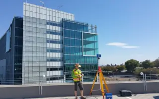
We provide comprehensive commercial surveying for infrastructure projects, including schools, bridges, and utility networks. Our team handles ALTA surveys, construction staking, and precision alignment for high-rise buildings. With experience in industrial engineering and GIS, we deliver accurate data for large-scale developments across California.
FEMA Elevation Certificates
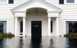
Our licensed surveyors create FEMA elevation certificates to determine flood insurance requirements. Using precise measurements, we help property owners potentially reduce insurance costs through LOMA filings. Emergency 48-hour service available for urgent needs across Northern California.
3D Laser Scanning
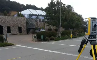
We utilize high-definition 3D laser scanning for building information modeling (BIM). This technology captures precise spatial data for as-built documentation, structural analysis, and historical preservation projects. Our services support construction planning and forensic investigations with millimeter accuracy.
Settlement Monitoring
Our real-time settlement monitoring system tracks building movement using advanced sensors. This 24/7 service documents vertical and horizontal displacement during construction or seismic events, supporting rapid reoccupation decisions and structural safety assessments in urban environments.
Expert Witness Services
Principal Stanley Gray provides expert witness testimony for property disputes and accident investigations. With over 30 years of surveying experience, we offer mediation services, boundary analysis, and courtroom-ready documentation for legal proceedings across California.
People
Stanley T. Gray
Principal Surveyor
California Licensed Land Surveyor with 30+ years of experience in boundary disputes, accident scene analysis, and expert testimony. Holds BS in Surveying Engineering and specializes in GIS/GPS automation technologies. Leads Meridian's litigation support services.
Questions
What services does Meridian provide for commercial clients?
We offer ALTA surveys, construction staking, settlement monitoring, and precision alignment for commercial infrastructure projects including high-rises, bridges, and utility networks.
How can a FEMA elevation certificate reduce flood insurance costs?
Our elevation certificates document building elevations relative to flood zones. If data shows properties above risk levels, we file LOMA requests to potentially remove flood insurance requirements.
Do you offer emergency surveying services?
Yes, we provide 48-hour emergency response for elevation certificates and time-sensitive projects across Northern California.
What advanced technologies do you use?
We employ HD 3D laser scanning, drone mapping, RTK GPS, and real-time settlement monitoring systems to enhance accuracy and efficiency for complex projects.
Are you certified for government contracts?
Yes, we hold CA State SBE and San Francisco LBE certifications, meeting local business enterprise requirements for public sector projects.
How does your settlement monitoring system work?
Our StabiAlert system uses precision sensors to track structural movement 24/7, providing real-time data on settlement, vibration, and seismic impacts for building safety assessments.