
Business Details
36 Years
experience
Advanced Geospatial Analytics Software Solutions
Since 1990, Bio Medware has been at the forefront of geospatial analytics software development, creating innovative tools that empower researchers and professionals to analyze complex space-time data. Our team combines decades of expertise in statistical modeling, environmental health, and geographic information systems to deliver solutions trusted by academic institutions, government agencies, and private sector clients worldwide. With over $25 million in research funding from prestigious organizations like NIH and NASA, we have built a reputation for technical excellence and methodological innovation. Our flagship product, Vesta, represents the culmination of this experience, offering advanced visualization capabilities and analytical tools that bridge the gap between sophisticated geostatistical methods and user-friendly interfaces.We maintain rigorous data security standards and provide comprehensive support to ensure our clients can focus on deriving meaningful insights from their data. Through continuous software evolution and active engagement with the research community, we remain committed to advancing spatial-temporal analysis methodologies and making them accessible to both experts and non-specialists alike.

Services
Geospatial Analytics
Space-Time Visualization
Statistical Modeling
Software Development
Technical Support
Details
- Year established: 1990
Highlights and features
- We offer 30+ years of experience in geospatial analytics software development
- Our tools are backed by $25M in NIH research funding and academic partnerships
- Vesta provides unique space-time visualization capabilities not found in other platforms
- We maintain strict data security protocols with no remote data storage
- Our software supports both expert statisticians and non-specialist researchers
What people say
User-friendly interface
Superior to other software
Saves time
Intuitive geostatistical mapping
Essential for research
Services
Geospatial Analytics
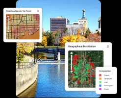
Our geospatial analytics tools enable comprehensive analysis of location-based data through advanced statistical methods and pattern detection algorithms. Researchers can identify spatial clusters, analyze geographic trends, and create predictive models for environmental and public health applications. The software supports both continuous and categorical data analysis with automated geostatistical modeling.
Space-Time Visualization
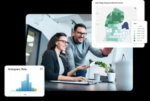
Vesta's space-time visualization capabilities allow users to create dynamic representations of data patterns across both geographic locations and time periods. The software enables interactive exploration through animated maps, time-series plots, and multi-dimensional data brushing. This helps researchers identify temporal trends in spatial distributions and communicate findings effectively through compelling visual narratives.
Statistical Modeling
Our statistical modeling tools incorporate joinpoint regression techniques and machine learning algorithms for analyzing complex datasets. The software supports compositional data analysis, spatial interpolation, and uncertainty quantification through geostatistical models. Users can perform cluster analysis, variogram modeling, and spatial downscaling with automated transform selection for accurate predictive analytics.
Software Development
We develop specialized geospatial software solutions tailored to specific research and industry needs. Our development process combines domain expertise in environmental health with cutting-edge computational methods to create intuitive interfaces for complex analytical tasks. The software incorporates state-of-the-art algorithms while maintaining accessibility for non-expert users through comprehensive documentation and support materials.
Technical Support
Our technical support services provide expert guidance for software implementation and data analysis challenges. Licensed users receive assistance with installation, troubleshooting, and methodological questions through dedicated support channels. We offer detailed documentation, tutorial resources, and direct consultation to ensure effective utilization of our geospatial analytics tools for diverse research applications.
Questions
What is Vesta used for?
Vesta is a geospatial analytics tool for visualizing and analyzing space-time data patterns. It helps researchers identify spatial clusters, track temporal trends, and create predictive models for applications in public health, environmental science, and urban planning.
How much does Vesta cost?
Vesta licenses start at $399/year for single-user access, with volume discounts and multi-year agreements available. Multi-user licenses begin at $575/year, with pricing decreasing for larger quantities and longer commitments.
Is Vesta secure for sensitive data?
Yes, Vesta does not store or transmit user data. All analyses occur locally on your machine, with no remote data retention. License validation uses encrypted keys and machine fingerprints for security without compromising data privacy.
What support options are available?
Licensed users receive free technical support through our dedicated support team. We provide assistance with installation, troubleshooting, and methodological questions during normal business hours, with responses typically within 48 business hours.
Can I try Vesta before purchasing?
Yes, we offer a 30-day free trial license for all users, including those who have previously accessed trial versions. This allows full access to Vesta's features for evaluation purposes.
What industries benefit most from Vesta?
Vesta serves public health researchers, environmental scientists, urban planners, and agricultural professionals. Its applications include cancer registry analysis, environmental exposure modeling, infrastructure assessment, and precision agriculture optimization through advanced spatial-temporal analytics.