Business Details
50+ Years
experience
Expert Land & Hydrographic Surveying Services in Jacksonville, FL
Degrove Surveyors has been a trusted leader in land and hydrographic surveying since 1971, serving clients across the Southeastern United States. With offices in Jacksonville and Gainesville, Florida, our team of licensed professionals combines decades of experience with cutting-edge technology to deliver precise, reliable geospatial data. Our expertise spans boundary surveys, hydrographic mapping, and utility location, supported by a fleet of specialized vehicles and watercraft for challenging terrains. We prioritize client collaboration, ensuring projects meet strict quality standards while adhering to deadlines. Our leadership includes ACSM-THSOA Certified Hydrographers and Geomatics-degreed technicians, reflecting our commitment to technical excellence.Degrove Surveyors maintains long-term partnerships with federal agencies, municipalities, and private-sector clients, driven by a dedication to accuracy and transparency. Our investment in advanced equipment, including multi-beam sonar and GPS systems, ensures adaptability to complex project demands. Recognized with awards like the JEA Blue Ribbon Award, we uphold a legacy of innovation and service excellence. Our teams certifications, including HYPACK and UTA qualifications, underscore our industry-leading expertise. Degrove Surveyors remains family-owned, blending generational knowledge with modern methodologies to address evolving client needs.
Services
Boundary Surveys
Hydrographic Surveying
Topographic Surveys
Subsurface Utility Location
Construction Stakeout
ALTA Surveys
GIS Mapping
Expert Witness Services
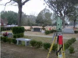
Cemetery Consulting
Multi-beam Sonar Surveys
Details
- Year established: 1971
Highlights and features
- 41 years of continuous operation with 25 years of hydrographic expertise
- Led by ACSM-THSOA Certified Hydrographers with nationwide recognition
- Investment in advanced equipment for remote and challenging environments
- Proven track record with federal agencies like FEMA and U.S. Army Corps of Engineers
- Geomatics-degreed technicians and TWIC-certified field crews
Associations and certifications
- ACSM-THSOA Certified Hydrographer
- HYPACK Certified
- HYSWEEP Certified
- UTA Certified Professional Subsurface Utility Locator
Services
Boundary Surveys
Our boundary surveys establish precise property lines using advanced GPS and robotic total stations. We analyze historical records and conduct field investigations to resolve disputes and support real estate transactions. Clients receive detailed documentation compliant with state and federal standards.
Hydrographic Surveying
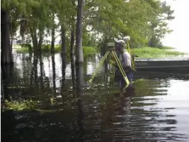
We perform single-beam and multi-beam sonar surveys for coastal, riverine, and offshore projects. Our certified hydrographers map underwater topography to support dredging, navigation, and environmental assessments. Data is processed using HYPACK software for high-resolution bathymetric charts.
Subsurface Utility Location
Using ground-penetrating radar and electromagnetic locators, we identify underground utilities to prevent excavation damage. Our UTA-certified technicians provide safe-dig plans and GIS integration for infrastructure projects, ensuring compliance with OSHA and local regulations.
Construction Stakeout
We translate engineering plans into physical markers for construction projects. Our team uses robotic total stations and GPS to ensure accurate placement of structures, utilities, and grading. Services support commercial, residential, and municipal developments across diverse terrains.
ALTA Surveys
Our ALTA/NSPS-compliant surveys meet rigorous standards for commercial real estate transactions. We document easements, encroachments, and improvements to support title insurance, reducing legal risks for buyers, sellers, and lenders nationwide.
People
Ray Niles
President
With 30+ years of experience, Ray Niles leads Degrove Surveyors as a licensed surveyor in seven states. A certified hydrographer and former FSMS president, he specializes in FEMA flood studies and coastal projects. He earned his degree from the University of Florida and mentors staff on technical and leadership excellence.
Brenda Catone
Project Manager
Brenda Catone manages complex surveys for residential and industrial developments. With a mathematics degree and 40+ years in the field, she excels in legal descriptions and utility mapping. Her expertise spans federal agencies and municipal projects, ensuring compliance with strict regulatory standards.
Matt Niles
Project Manager
Matt Niles specializes in hydrographic surveys, with experience across three continents. Holding a master's in hydrographic science, he directs offshore and inland water projects using multi-beam sonar. His certifications include FIG/IHO Category A Hydrographer, ensuring global project compliance.
Questions
What services does Degrove Surveyors offer?
We provide boundary surveys, hydrographic mapping, subsurface utility location, construction stakeout, ALTA surveys, and expert witness services using advanced geospatial technology.
Which areas do you serve?
Degrove Surveyors operates throughout the Southeastern U.S., including Florida, Georgia, Alabama, Mississippi, Louisiana, and the Carolinas, with offices in Jacksonville and Gainesville, Florida.
Are your surveyors certified?
Yes, our team includes ACSM-THSOA Certified Hydrographers, HYPACK-certified professionals, and UTA-certified subsurface utility locators, ensuring compliance with industry standards.
How do you handle challenging environments?
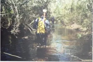
We use specialized equipment like amphibious vehicles, multi-beam sonar, and GPS systems to survey remote swamps, coastal areas, and dense urban environments efficiently.
What industries do you work with?
Our clients include federal agencies, municipalities, real estate developers, and environmental firms requiring precise data for infrastructure, coastal, and land development projects.
Can you assist with emergency projects?
While we don’t offer 24/7 emergency services, our teams prioritize rapid mobilization for time-sensitive surveys, leveraging local offices and equipment for quick response.