
Business Details
50+ Years
experience
Trusted Surveying & Civil Engineering Services in Glendale
Founded in 1924, Mollenhauer Group has built a legacy of excellence in surveying, civil engineering, and 3D laser scanning. Our team of licensed professionals combines decades of experience with cutting-edge technology to deliver precise solutions for commercial, residential, and industrial projects. Headquartered in Glendale, California, we serve Southern California with a focus on client satisfaction, innovation, and ethical practices.Our expertise spans ALTA surveys, civil engineering design, and BIM modeling, supported by a track record of repeat work with government agencies, developers, and architectural firms. We prioritize technical accuracy, timely deliverables, and tailored services to meet the unique needs of each project.
Services
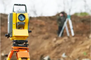
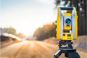
Land Surveying
Civil Engineering
3D Laser Scanning
BIM Modeling
Utility Detection
ADA Compliance Plans
Topographic Surveys
Construction Surveying
Details
- Year established: 1924
Highlights and features
- 99 years of experience in surveying and civil engineering.
- Specialized technical staff with expertise in 3D BIM modeling.
- Proven track record with government agencies and private developers.
- Timely, accurate deliverables using state-of-the-art technology.
- Comprehensive services from ALTA surveys to ADA compliance plans.
What people say
Quality deliverables
Unparalleled expertise
Accurate and timely
Successful partnerships
Innovative solutions
Services
Land Surveying
Mollenhauer Group provides precise land surveying for commercial, residential, and industrial projects. Services include ALTA/ACSM surveys, topographic mapping, and boundary determinations. Our expertise ensures compliance with legal and development requirements.
Civil Engineering
Our civil engineering team specializes in site development, grading, drainage, and utility design. We deliver LEED-compliant solutions and stormwater management plans for schools, healthcare facilities, and urban infrastructure projects.
3D Laser Scanning
Using FARO Focus 3D scanners, we create accurate point cloud data and BIM models for architects and contractors. Our services support historical preservation, facility management, and construction coordination with millimeter precision.
People
Gregory D. Hindson
Principal Professional Land Surveyor
Gregory D. Hindson leads surveying operations with over 30 years of expertise in ALTA surveys and boundary analysis. He ensures technical accuracy and compliance with state and federal standards.
Thomas Tran
Senior Vice-President Professional Civil Engineer
Thomas Tran oversees civil engineering projects, specializing in site development and stormwater management. His leadership ensures innovative, code-compliant solutions for complex urban infrastructure.
Rick Harris
Innovation/Technology Manager
Rick Harris directs 3D scanning and BIM initiatives, leveraging 20+ years of experience to integrate cutting-edge technology into surveying and engineering workflows.
Questions
What services does Mollenhauer Group Civil offer?
We specialize in land surveying, civil engineering, 3D laser scanning, and BIM modeling for commercial, residential, and industrial projects.
How long has Mollenhauer Group Civil been in business?
We have served Southern California since 1924, providing surveying and engineering services for nearly a century.
What industries do you work with?
We serve government agencies, private developers, architects, schools, healthcare providers, and construction firms.
Do you handle complex or large-scale projects?
Yes, our team manages projects of all scales, including high-rise buildings, school districts, and infrastructure developments.
Are your professionals licensed and certified?
Yes, our team includes licensed land surveyors, civil engineers, and BIM specialists with state and industry certifications.