
Business Details
27 Years
experience
Professional Land Surveying Services Charleston SC
Atlantic Surveying has been delivering comprehensive land surveying services in the Low Country since 1980. Our expertise spans subdivision planning, topographic surveys, boundary line adjustments, and property splits for residential and commercial clients. With a team of licensed professionals and advanced equipment, we provide precision in construction surveying, floodplain determinations, and engineering surveys. Our experience includes military facilities, industrial projects, and multi-phase subdivisions. We integrate electronic data collection with CAD technology to ensure quality and efficiency.Since 1999, our staff has combined over 38 years of experience, including two Professional Land Surveyors licensed in South Carolina. Our dedicated team ensures seamless field-to-office coordination for all surveying needs. We prioritize client satisfaction through timely delivery and adherence to industry standards. Our services support residential builders, commercial developers, and government agencies. Atlantic Surveying remains committed to innovation and excellence in every project.

Services
GPS Mapping
Topographic Surveys
Construction Staking
Flood Elevation Certificates
Boundary Retracement
Subdivision Plats
Wetland Surveys
Utility As-Builts
Coastal Permitting
Expert Witness Testimony
Details
- Year established: 1999
Highlights and features
- We have over 40 years of combined experience in land surveying.
- Our team includes licensed Professional Land Surveyors in South Carolina, Georgia, and Florida.
- We utilize advanced GPS and CAD technology for accurate results.
- We offer comprehensive services from boundary surveys to construction staking.
- Our staff provides seamless field-to-office project management.
Services
Topographic Surveys
Topographic surveys capture natural and man-made features for construction or land development. We use advanced equipment to map elevations, contours, and structures. Ideal for architects, engineers, and property owners planning improvements.
Construction Staking
Our construction staking ensures accurate placement of buildings and infrastructure. We translate design plans into physical markers for residential, commercial, and municipal projects. Precision is critical for compliance and minimizing costly errors.
Flood Elevation Certificates
Flood elevation certificates determine base flood elevations for insurance and compliance. Required after Charleston County's 2021 flood map updates. Helps property owners secure accurate flood insurance rates using NAVD88 datum.
Boundary Retracement
Boundary retracement surveys re-establish property lines using historical records and physical evidence. Resolves disputes, supports land transfers, and ensures legal compliance. Essential for real estate transactions and development.
Subdivision Plats
We prepare subdivision plats for residential and commercial developments. Services include design, engineering, and regulatory approval assistance. Ensures compliance with local zoning and infrastructure requirements for seamless project execution.
People
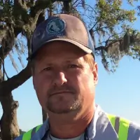
James Kelly Davis
Registered Land Surveyor/Owner
Licensed in SC, GA, and FL with over 2000 projects completed. Specializes in military, roadway, and utility surveys. Graduate of The Citadel with BS in Civil Engineering. Active in professional surveying societies.
Sonya deTournillon
Managing Director
27 years in management and marketing. Certified in AutoCAD and FEMA flood programs. Focuses on business development and client relations. Member of Charleston Home Builders Association and USGBC.
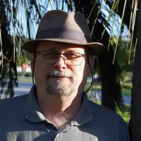
Covert B. Nelson
Registered Land Surveyor
40+ years of experience in roadway, railway, and utility surveys. Certified in Trimble GPS and HAZMAT. Worked on Walgreens, Cracker Barrel, and military construction projects across the Southeast.
Lauren Caughill
Admin and Assistant Researcher
Charleston native with 15 years of customer service experience. Assists with property research and FEMA certifications. Pursuing further training in emergency management programs.
Bob Willson
Drafter / Construction Layout Assistant
Carlson/AutoCAD trained with experience in as-builts and residential surveys. Background in IT and software. Graduated from James Island Charter High School. Handles diverse technical challenges.
Questions
What services does Atlantic Surveying offer?
We provide land surveying services including boundary surveys, topographic mapping, construction staking, flood elevation certificates, subdivision plats, and engineering surveys for residential, commercial, and government clients.
Why are flood elevation certificates important after 2021?
Charleston County adopted new flood maps using NAVD88 datum in 2021. Existing properties need updated elevation certificates to reflect the new standard and qualify for accurate insurance rates.
Do you serve commercial and residential clients?
Yes, we work with both residential homeowners and commercial developers for surveys, construction staking, and regulatory compliance across Charleston, Berkeley, and Dorchester Counties.
How experienced is your team?
Our team includes licensed surveyors with over 40 years of combined experience. We've completed thousands of projects ranging from military facilities to multi-unit apartment complexes.
Can you handle complex surveying projects?
Yes, we specialize in challenging projects like wetland surveys, coastal permitting, and engineered flood vent installations. Our expertise includes NAVSTAR GPS control networks for military bases.
How do I request a survey?
Call 843-763-6669 or use our online form to discuss your project. Our staff will provide a quote and schedule services tailored to your residential or commercial needs.