Business Details
47 Years
experience
Professional Land Surveyors in Temple, TX
Ronald Carroll Surveyors has been delivering professional land surveying services since 1979, serving residential, commercial, and governmental clients across Texas and Oklahoma. Our commitment to accuracy, integrity, and client satisfaction is rooted in rigorous quality control measures, including inspections by our Registered Professional Land Surveyors (RPLS). We utilize advanced technologies such as FAA-certified drone services and GIS mapping to ensure precise data collection and analysis. As a Small Business Administration (SBA)-classified small business, we maintain certifications like TXDOT S.B.E. and FAA Small UAS, underscoring our adherence to industry standards. Our team prioritizes open communication, timely deliverables, and tailored solutions for projects ranging from boundary surveys to complex construction layouts.With licenses from the Texas and Oklahoma Boards of Professional Engineers and Land Surveyors, we uphold the highest professional and ethical standards. Our affiliations with organizations like the National Society of Professional Surveyors (NSPS) and Texas Society of Professional Surveyors (TSPS) reflect our dedication to advancing the field. Client testimonials highlight our reliability, technical expertise, and ability to meet aggressive deadlines without compromising quality. We approach every project with core values of commitment, honesty, and respect, ensuring both employees and clients receive unparalleled attention to detail. Whether supporting infrastructure development or resolving property disputes, we remain focused on delivering trusted, data-driven surveying solutions.
Services
Land Boundary Survey
Title Survey
ALTA/NSPS Survey
Subdivision Platting
Construction Survey
Aerial Mapping
GIS Mapping
FEMA Elevation Certificate
Hydrographic Survey
Cell Tower Survey
Details
- Year established: 1979
Highlights and features
- We have over 40 years of experience in land surveying across Texas and Oklahoma.
- Our FAA-certified drone services enhance mapping precision and efficiency.
- We maintain rigorous quality control with inspections by Registered Professional Land Surveyors.
- Our SBA-certified small business status ensures personalized, client-focused service.
- We hold licenses from the Texas and Oklahoma Boards of Professional Engineers and Land Surveyors.
Associations and certifications
- TXDOT S.B.E.
- FAA Small UAS Certificate
What people say
Timely deliverables
High level of competence
Quick response
Quality products
True partner
Services
Land Boundary Survey
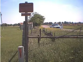
We determine property lines and easements using precise measurements and legal records. Our surveys identify improvements, deed lines, and restrictions for landowners, lenders, and title companies. This service ensures compliance with local regulations and resolves disputes over land ownership.
Aerial Mapping Service
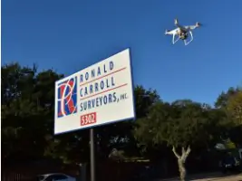
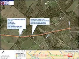
Our FAA-certified drone operations capture high-resolution topographic data for large-scale projects. This technology enables efficient site analysis, construction monitoring, and asset management. Data integrates seamlessly with GIS systems for comprehensive spatial planning.
Construction Survey
We provide precise staking and elevation control for residential, commercial, and infrastructure projects. Our surveys guide grading, foundation placement, and utility installation. Clients rely on our work to ensure structures align with design plans and regulatory requirements.
ALTA/NSPS Land Title Survey
These detailed surveys meet lenders' and title companies' requirements for commercial transactions. We include Table A items like easements, encroachments, and zoning restrictions. Our ALTA/NSPS surveys provide critical risk assessment for multi-state property acquisitions.
FEMA Elevation Certificate
We document building elevations relative to flood zones for insurance compliance. This service helps property owners secure accurate flood risk assessments. Our certificates meet FEMA guidelines for communities participating in the National Flood Insurance Program.
Questions
What geographic areas do you serve?
We provide surveying services throughout Texas and Oklahoma, with expertise in both urban and rural land development projects.
Are you certified for drone-based mapping?
Yes, we hold an FAA Small UAS Certificate (FA3RFT7H7Y) for aerial survey operations and data collection.
What survey types are required for property purchases?
Title (mortgage) surveys and ALTA/NSPS surveys are commonly needed to satisfy lenders and title companies during real estate transactions.
How do you ensure survey accuracy?
We implement quality control checks by Registered Professional Land Surveyors and use calibrated equipment meeting state licensing standards.
Can you handle government infrastructure projects?
Yes, we're TXDOT S.B.E. certified and have completed FAA and municipal projects including roads, utilities, and floodplain mapping.