Business Details
39 Years
experience
Professional Land Surveying Services in Denton, TX
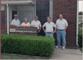
Since 1987, Landmark Surveyors has established itself as a trusted provider of comprehensive land surveying services in Denton County. With over 18,000 completed surveys, our expertise spans residential, commercial, and municipal projects, including metes & bounds surveys, topographic mapping, and FEMA elevation certificates. Our team of licensed professionals brings decades of combined experience across Texas, California, and Illinois, ensuring precision and reliability in every project. We prioritize client needs through transparent communication, competitive pricing, and a commitment to protecting property integrity. Our staff includes seasoned experts like President Jerald Yensan, a registered professional land surveyor with international experience, and office manager Vicky Carter, a former FEMA Natural Hazards Program Specialist.We specialize in resolving property disputes, preparing subdivision plats, and providing forensic surveying for legal cases. Our investment in advanced technology and adherence to industry standards guarantees accurate results for clients ranging from individual homeowners to large-scale developers. By maintaining a focus on timely service and ethical practices, we have become a go-to resource for Denton County landowners. Our teams diverse backgrounds in civil engineering, geography, and construction staking enable us to tackle complex surveying challenges efficiently. Whether addressing flood insurance requirements or preparing right-of-way acquisitions, we deliver solutions tailored to each clients unique needs.
Services
Land Surveys
Subdivision Plats
FEMA Elevation Certificates
Topographic Surveys
Construction Staking
Details
- Year established: 1987
Highlights and features
- We have performed over 18,000 surveys in Denton County since 1987.
- Our team includes licensed professionals with international surveying experience.
- We specialize in resolving property disputes and flood insurance requirements.
- Our office manager brings 14 years of FEMA hazard program expertise.
- We combine advanced technology with competitive pricing for client value.
Services
Land Surveys
Our land surveys precisely define property boundaries using metes & bounds methodology. We identify encroachments, easements, and setbacks that could impact ownership rights. This service helps prevent disputes during real estate transactions or property development projects.
FEMA Elevation Certificates
We provide FEMA-certified elevation certificates to determine flood zone status and insurance requirements. These documents help property owners qualify for lower flood insurance rates or potentially eliminate coverage needs through official map amendments.
Subdivision Plats
Our subdivision plats create legally recognized property divisions for residential or commercial development. We ensure compliance with municipal regulations and prepare documentation for county approval of new lot configurations.
Topographic Surveys
We map natural and man-made features including elevation changes, vegetation, and structures. This data supports construction planning, drainage analysis, and environmental impact assessments for development projects.
Construction Staking
Our construction staking services mark precise locations for building foundations, utilities, and infrastructure. We ensure projects adhere to approved plans and local zoning requirements throughout the development process.
People
Jerald Yensan
President
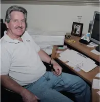
Registered Professional Land Surveyor with 60+ years experience across five countries. Holds degrees from Moody Bible Institute and Monterey Peninsula College. Oversees all survey operations and client relations.
Vicky Carter
Office Manager
Former FEMA Natural Hazards Program Specialist with 14 years of flood map expertise. Manages client communications and coordinates survey scheduling and documentation.
Steven Billmeier
Field Technician
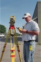
Certified CADD technician with 30+ years experience in Denton County. Specializes in construction staking and boundary survey fieldwork using advanced GPS equipment.
Bradley Hamilton
CADD Technician
Geography graduate with urban planning expertise. Creates detailed survey maps and digital documentation for subdivision plats and topographic surveys.
Kyle Whitley
Field Technician
Former professional baseball pitcher turned surveyor. Combines physical precision with technical skills for accurate field measurements and property boundary determinations.
Questions
Why do I need a land survey?
A survey identifies property boundaries, easements, and potential disputes that could affect ownership rights or property use.
Can I reuse the seller's existing survey when buying a home?
Old surveys may be outdated due to boundary changes, new easements, or updated flood maps requiring current documentation.
Do you provide FEMA elevation certificates?
Yes, we prepare FEMA-certified elevation certificates to determine flood insurance requirements and potential rate reductions.
What types of surveys do you perform?
We offer boundary surveys, topographic maps, subdivision plats, construction staking, and forensic surveys for legal cases.
How much does an elevation certificate cost?
Our flat rate for elevation certificates is $500.00, tax-exempt regardless of property size or value.