
Business Details
29 Years
experience
Professional Land Surveying Services in Clarksville, TN
Founded in 1997, Byrd Surveying has established itself as a trusted provider of comprehensive land surveying services across Tennessee, Kentucky, and Alabama. Our team of dedicated professionals brings over 25 years of combined experience to deliver accurate and reliable data for commercial construction, development projects, and home builder services. Specializing in boundary surveys, topographic surveys, and ALTA/NSPS surveys, we utilize advanced technical equipment to ensure precision in every project. With a track record of completing over 22,000 projects, we partner with local and national clients to transform paper plans into real-world developments. Our commitment to quality extends to infrastructure layout, subdivision planning, and erosion control, supporting clients from initial design to final execution.We prioritize clear communication and technical excellence, offering services like construction staking, utility line mapping, and FEMA flood certification. Our staffs expertise in zoning regulations and courthouse research ensures compliance with local requirements while maintaining efficiency. By blending innovation with decades of field experience, we provide actionable data that empowers informed decision-making. Our clients benefit from transparent processes, timely delivery, and a focus on meeting project-specific needs. As a multidisciplinary firm, we remain dedicated to advancing surveying standards while maintaining personalized service for every client.
Services
Commercial Construction Surveys
Topographic Surveys
Boundary Surveys
ALTA/NSPS Surveys
Subdivision Planning
Construction Staking
Erosion Control Mapping
Utility Line Surveys
Flood Certification
Infrastructure Layout
Details
- Year established: 1997
Highlights and features
- We have over 25 years of experience in land surveying across three states.
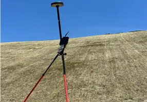
- Our team uses advanced technical equipment for the most accurate data collection.
- We complete over 22,000 projects including complex commercial and residential developments.
- Our staff includes professionals trained in zoning regulations and courthouse research.
- We provide full-service support from initial surveys to final construction staking.
Services
Commercial Construction Surveys
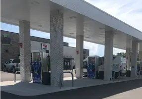
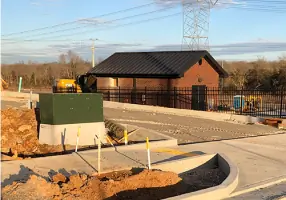
Our commercial construction surveys translate architectural plans into physical site markers using precision staking. We locate building corners, drainage structures, and utility lines to guide development. This service ensures accurate implementation of designs for hotels, medical facilities, and industrial sites.
Topographic Surveys
Topographic surveys document natural features and man-made improvements with elevation data. We map trees, streams, buildings, and roads to create detailed site models. This information supports engineering and architectural planning for development projects.
Boundary Surveys
Boundary surveys establish legal property limits and identify easements. We conduct courthouse research and field measurements to define land ownership. This service prevents disputes and ensures compliant site development.
ALTA/NSPS Surveys
ALTA/NSPS surveys meet national standards for commercial property transactions. We document boundaries, improvements, and encumbrances required by lenders. This service provides critical data for land title insurance and development decisions.
Subdivision Planning
Subdivision planning services support residential and commercial land division. We create plat designs and erosion control plans for developments ranging from 5 to 500 lots. Our work ensures compliance with local zoning and infrastructure requirements.
Questions
What geographic areas do you serve?
We provide surveying services throughout Tennessee, Kentucky, and Alabama.
How long has your company been in business?
Byrd Surveying has delivered land surveying services since 1997.
What types of surveying services do you offer?
We specialize in commercial construction surveys, boundary determinations, topographic mapping, and ALTA/NSPS standards compliance.
Do you work with residential home builders?
Yes, we collaborate with over 15 home builders in Middle Tennessee on subdivision projects.
What equipment do you use for surveys?
We utilize advanced technical equipment to ensure the highest accuracy in data collection.
Can you assist with flood certification requirements?
Yes, we provide FEMA flood certification as part of our development services.