Business Details
18 Years
experience
Professional Land Surveying Services in Washington
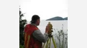
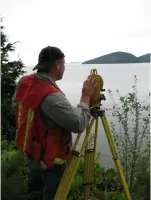
360 Surveying & Mapping has delivered efficient surveying services and expert project management since 2008. Our team combines decades of field and office experience to serve landowners, architects, engineers, and contractors across Puget Sound. Specializing in boundary surveys, construction layout, drone mapping, and laser scanning, we leverage modern technology to meet client needs while maintaining quality and value. With expertise in King, Snohomish, Skagit, Whatcom, and Island counties, we provide tailored solutions for complex surveying challenges. Our owner-operated structure ensures personalized service and accountability.The DeCamp family legacy in surveying, dating back to the Great Northern Railway era, underscores our deep-rooted commitment to precision. We utilize GPS, drone, and traditional methods to create accurate topographic and ALTA surveys. Our construction layout and QC services support civil projects from foundation staking to grid control. Laser scanning expertise enables seamless integration with BIM and CAD software for innovative projects. Clients benefit from our hands-on approach and technological edge across Washington State.

Services
Topographic Survey
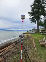
GPS Surveys
Drone Mapping
Boundary Line Adjustments
Laser Scanning
Construction Layout
ALTA Surveys
Unit Lot Subdivisions
Details
- Year established: 2008
Highlights and features
- We offer 25 years of hands-on surveying experience since 2000
- Our team combines GPS, drone, and traditional surveying methods
- We serve 5+ counties across Puget Sound region
- Owner-operated with direct project management oversight
- Family legacy in surveying dating back to railway construction era
Services
Topographic Survey
Our topographic surveys combine traditional methods with drone and GPS technology to create detailed terrain models. These surveys support construction planning, land development, and environmental assessments. Clients receive accurate elevation data and contour maps for informed decision-making.
Drone Mapping
Utilizing drone technology, we capture high-resolution aerial data for large-scale mapping projects. This method improves logistics and accuracy for lot surveys and topographic mapping. Clients benefit from faster turnaround times and comprehensive site analysis.
Boundary Line Adjustments
We specialize in boundary line adjustments across four Washington counties. Our surveys resolve property disputes and facilitate land transactions. With decades of experience, we ensure compliance with local regulations and historical records.
Construction Layout
Our construction layout services guide foundation placement and site development. We provide precise staking for buildings, utilities, and infrastructure projects. Contractors rely on our QC services to maintain alignment with design specifications.
Laser Scanning
We use laser scanning to create detailed 3D models for BIM integration and as-built documentation. This technology captures complex spaces efficiently. Our expertise ensures seamless compatibility with CAD software for construction and design teams.
People
Ken DeCamp
Owner / Founder
Ken DeCamp has 25 years of surveying experience since 2000. He leads projects involving construction, cadastral, and drone surveys. His family legacy in surveying spans three generations, including railway and bridge engineering history.
Questions
What areas do you serve?
We provide surveying services throughout Washington State, with primary focus on King, Snohomish, Skagit, Whatcom, and Island counties.
What surveying technologies do you use?
We combine GPS, drone mapping, laser scanning, and traditional methods to deliver accurate results for various project requirements.
Can you handle complex boundary disputes?
Yes, with decades of experience in boundary work, we resolve complex property disputes and provide expert documentation for legal matters.
Do you offer construction layout services?
We provide complete construction layout support including foundation staking, grid control, and quality checks for building projects.
How do you ensure survey accuracy?
Our team uses calibrated equipment and follows strict quality control procedures. We combine modern technology with traditional surveying techniques for maximum precision.