
Business Details
47 Years
experience
Your Trusted Land Surveying Partner in Corpus Christi
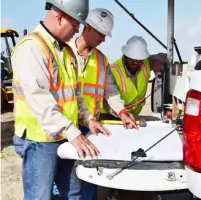
Frontier Surveying has been a trusted leader in land surveying since 1979, specializing in oil and gas, pipeline, construction, and environmental projects across Texas. Our team combines Registered Professional Land Surveyors with cutting-edge technology, including 3D laser scanning, UAV drones, and GIS systems, to deliver precise, efficient solutions. We prioritize client satisfaction through continuous innovation, safety excellence, and a commitment to sustainable development.Our deep expertise in Texas geographies, from the Permian Basin to the Gulf Coast, ensures tailored services for complex industry needs. With decades of experience and a culture of professional growth, we maintain rigorous standards for quality, ethics, and environmental stewardship.
Services
Land Surveying
GIS Services
Oil and Gas Surveys
Pipeline Surveys
3D Laser Scanning
UAV Drone Mapping
Hydrographic Surveys
Construction Surveys
Topographic Surveys
Boundary Surveys
Details
- Year established: 1979
Highlights and features
- We have over 40 years of experience in Texas land surveying.
- Our team uses advanced 3D scanning and UAV drone technology.
- We specialize in complex oil and gas and pipeline projects.
- We maintain rigorous safety and environmental stewardship standards.
- Our leadership includes field-trained experts with decades of experience.
Associations and certifications
- Texas Board of Professional Land Surveyors
Services
Land Surveying
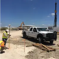
We provide precise boundary and surface ownership surveys for oil and gas, pipeline, and construction projects. Our services include mineral lease research, easement staking, and Texas Railroad Commission platting. With decades of experience in Texas geographies, we ensure compliance with state regulations and deliver accurate data for legal documentation and project planning.
GIS Services
Our cloud-based GIS services integrate multiple data layers for comprehensive mapping solutions. We tailor data collection and translation to meet client specifications, supporting decision-making processes. From topographic maps to asset management systems, our GIS expertise enhances project efficiency and accuracy for industries like oil and gas, utilities, and transportation.
3D Laser Scanning
Using Leica 3D scanners and lidar technology, we capture high-resolution spatial data for industrial applications. Our services include cross-section analysis, construction quality assurance, and volumetric surveys. This technology enables detailed asset management and precise documentation of complex infrastructure for oil and gas, mining, and construction sectors.
UAV Surveying
Our UAV technology delivers aerial imaging, 3D modeling, and topographic surveys with reduced risk and cost. Drones enable rapid data acquisition in inaccessible areas, supporting land planning and environmental assessments. This innovative approach improves data density and resolution for projects requiring efficient, high-quality surveying solutions.
Pipeline Surveys
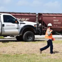
We offer comprehensive pipeline surveying services, including route staking, as-built surveys, and hydrographic assessments. Our team has extensive experience in Texas' active energy plays, providing accurate data for pipeline planning, permitting, and compliance. From landowner exhibit plats to T-4 permit mapping, we support safe and efficient pipeline development.
People
Ivy Young
President and CEO
Ivy Young leads Frontier Surveying with over 25 years of field and executive experience. Starting as a field technician in the 1990s, she champions client satisfaction, technological innovation, and professional development. Her leadership drives the company's growth and commitment to industry excellence.
Questions
What industries do you serve?
We specialize in oil and gas, pipeline, construction, utilities, transportation, and environmental projects across Texas and its coastal waters.
What technologies do you use?
We employ 3D laser scanning, UAV drones, GNSS RTK systems, lidar, and advanced GIS software for precise, efficient surveying solutions.
Are you licensed in Texas?
Yes, we hold Texas Board of Professional Land Surveyors License #10082900 and have operated continuously since 1979.
Do you work in remote areas?
Yes, our UAV technology and field expertise allow us to survey inaccessible locations, including over 20,000 Texas sites since 1979.
How do you ensure safety?
We maintain an Injury- and Incident-Free environment through rigorous training, safety certifications, and a culture prioritizing employee and client well-being.
What regions of Texas do you cover?
We operate statewide, including the Permian Basin, Eagle Ford, Barnett Shale, Gulf Coast, and Haynesville regions.