
Business Details
45 Years
experience
Advanced Mining Software Solutions
Maptek KRJA Systems has been a leader in mining technology since 1981, dedicated to empowering miners with advanced software solutions that enhance decision-making and operational efficiency. Our focus on integrated decision support systems enables clients to transform raw data into actionable insights at every stage of the mining lifecycle. With decades of industry expertise, we prioritize customer-driven innovation, investing in cutting-edge technologies and partnerships to deliver tailored solutions.Our global team of experts combines deep mining knowledge with technical excellence to optimize geological modeling, mine planning, and safety systems. We are committed to reshaping the future of mining through automation, machine learning, and cloud-based platforms that address evolving industry challenges. Our culture of collaboration and continuous improvement ensures clients receive reliable, scalable tools that maximize productivity and sustainability.
Services
Geological Modeling
Mine Scheduling
Proximity Awareness
Survey Data Management
Drone Data Processing
Details
- Year established: 1981
Highlights and features
- We offer 40+ years of specialized expertise in mining software development.
- Our integrated platforms streamline workflows from exploration to production.
- We provide localized technical support in 10+ countries.
- Our solutions leverage machine learning and cloud automation for precision.
- We partner with leading mining firms for tailored problem-solving.
Services
Geological Modeling
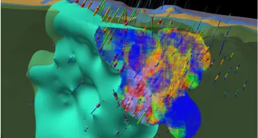
Our geological modeling software streamlines data validation to 3D model generation, enhancing accuracy for resource estimation and mine planning. It integrates machine learning to automate domain definition, reducing manual input while improving reliability. Designed for geologists and mining engineers, this tool ensures data-driven decisions for complex orebody interpretations.
Mine Scheduling
Interconnected mine scheduling solutions optimize short- and long-term planning by analyzing multiple scenarios for operational viability. The platform supports strategic resource allocation and risk assessment, ensuring compliance with environmental and safety standards. It enables real-time adjustments to maximize productivity and profitability across open-pit and underground operations.
Proximity Awareness
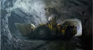
Underground proximity awareness systems use advanced sensors to detect and alert personnel about vehicle and equipment hazards. This technology reduces collision risks in confined spaces, enhancing worker safety and operational efficiency. It integrates seamlessly with existing mine infrastructure for real-time monitoring and incident prevention.
Survey Data Management
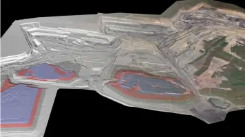
Dynamic survey surface management automates updates to create a single source of truth for project timelines. The system processes LiDAR and drone data to maintain accurate topographical records, supporting deformation monitoring and compliance reporting. It ensures data consistency for large-scale mining projects.
Drone Data Processing
Point cloud processing tools convert drone and mobile sensor data into actionable deliverables for quarry and civil engineering applications. The software supports rapid analysis of terrain changes, stockpile volumes, and structural integrity assessments. It integrates with cloud platforms for collaborative, real-time decision-making.
People
Will Reid
Mining Engineer
Will Reid specializes in surface management systems, focusing on integrating data for operational efficiency. With 15 years in mining technology, he drives innovation in single-source data solutions.
James Mackenzie
Automation Specialist
James Mackenzie leads automation initiatives, developing platforms that enhance strategic decision-making. His expertise in orchestration systems has optimized processes for global mining operations over 12 years.
Questions
What mining software solutions does Maptek KRJA Systems offer?
We provide geological modeling, mine scheduling, proximity awareness, and survey data management tools tailored for exploration to production stages.
How does Maptek KRJA Systems support mine safety?
Our VisionV2X system uses proximity detection to prevent underground collisions, while Sentry monitors surface movement for hazard prevention.
Can Maptek KRJA Systems integrate with existing mine systems?
Yes, our cloud ecosystem and APIs ensure seamless integration with third-party platforms and legacy infrastructure for unified workflows.
Do you offer training for your software?
We provide customized online and on-site training programs for Vulcan, Evolution, and other tools to maximize user proficiency and operational outcomes.
How does Maptek KRJA Systems handle data accuracy?
Machine learning algorithms and automated validation processes ensure high precision in geological models and resource estimations.
Videos