
Business Details
Your Trusted Partner for Land Surveying Solutions
At Diamondback Land Surveying, we are committed to delivering precise and reliable land surveying solutions across 19 states. Our mission centers on providing timely, accurate, and high-quality services while fostering long-term relationships with clients. With expertise in residential, commercial, and public works projects, we specialize in boundary surveys, construction staking, topographic mapping, and high-definition 3D laser scanning. Our team combines advanced technology with industry experience to meet diverse surveying needs.We prioritize integrity, professionalism, and innovation in every project, ensuring client satisfaction through meticulous attention to detail. As we continue to grow, we remain dedicated to adopting cutting-edge methodologies and maintaining our reputation for excellence in the surveying profession. Our services support engineering, construction, and development communities nationwide, offering tailored solutions that align with evolving industry standards.
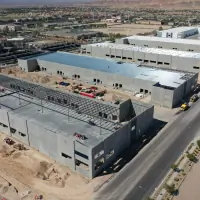
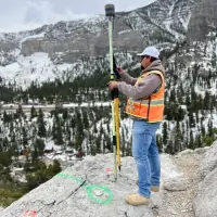
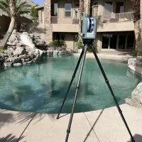
Services
Land Surveying
Construction Staking
Topographic Surveys
ALTA Surveys
3D Laser Scanning
Highlights and features
- We utilize advanced technology for accurate surveying results.
- Our team serves clients across 19 states with nationwide expertise.
- We prioritize integrity and professionalism in every project.
- We offer comprehensive services for residential, commercial, and public works projects.
- We maintain a relentless focus on quality and client satisfaction.
Services
Land Surveying
Our land surveying services encompass boundary and cadastral surveys, utility mapping, and water rights assessments. We provide precise data for property development, legal documentation, and construction planning. Our team ensures compliance with state and federal standards for accuracy.
Construction Staking
We deliver precise construction staking for residential, commercial, and public infrastructure projects. Our services include boundary staking, utility layout, and building alignment to guide construction teams. Advanced GPS technology ensures adherence to project specifications.
Topographic Surveys
Our topographic surveys capture detailed elevation data and natural/ man-made features using photogrammetry and GPS. These surveys support site planning, drainage analysis, and environmental assessments. Data is delivered in digital formats for engineering use.
ALTA Surveys
We conduct ALTA/NSPS surveys to meet title insurance requirements for commercial properties. Our surveys include boundary verification, easement identification, and improvements mapping. Results are delivered with legal descriptions and certification.
3D Laser Scanning
Our high-definition 3D laser scanning captures detailed as-built conditions for structures and sites. Applications include facility management, historical documentation, and construction verification. Point cloud data is processed for BIM and CAD integration.
Questions
What services does Diamondback Land Surveying offer?
We provide land surveying, construction staking, topographic surveys, ALTA surveys, and 3D laser scanning for residential, commercial, and public works projects.
Which areas do you serve?
We operate across 19 states including Arizona, California, Nevada, New Mexico, Oregon, Utah, and Washington.
How can I request a free quote?
Contact us at 702.823.3257 or visit our website to submit your project details for a free consultation.
What technologies do you use?
We utilize GPS, photogrammetry, and high-definition 3D laser scanning to ensure precision in all surveying projects.
Are your surveyors licensed professionals?
Yes, our team consists of certified professionals with expertise in land surveying and mapping disciplines.