
Business Details
35 Years
experience
Expert Land Surveying Services in Fresno, CA
ESP Surveying, established in 1991, is a full-service land surveying firm headquartered in Fresno, California, with an office in Sacramento. Our team of licensed surveyors, registered engineers, and construction managers specializes in boundary surveys, topographic mapping, construction staking, and ALTA surveys, utilizing advanced GPS equipment and robotic total stations. With over three decades of experience, we serve public agencies and private developers across California, offering personalized attention and rapid mobilization through our state-of-the-art field and office technologies.Our commitment to precision is supported by comprehensive insurance coverage and certifications including DBE, SBE, and WOSB. We maintain rigorous safety standards with 40-hour Hazardous Waste Certification for field personnel and leverage digital tools for seamless client communication and project management.
Services
Topographic Surveys
Aerial Control Surveys
Construction Staking
Boundary Surveys
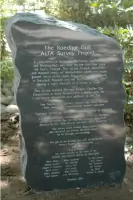
ALTA Surveys
Hazmat Surveys
Subdivision Maps
GIS Mapping
UAV Surveys
Property Divisions
Details
- Year established: 1991
Highlights and features
- Established in 1991 with continuous service for 30+ years
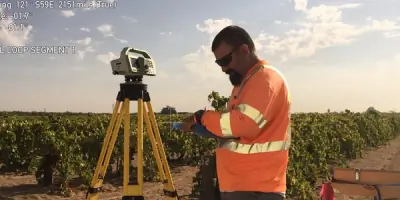
- Utilize GPS and robotic total stations for precise measurements
- Certified professionals with 40-hour Hazardous Waste Training
- Comprehensive insurance coverage for risk mitigation
- DBE/SBE/WOSB certifications for government contracting eligibility
Associations and certifications
- CALTRANS
- Department of General Services
- CPUC
Services
Topographic Surveys
Our topographic surveys create detailed elevation models using robotic total stations and GPS technology. This service helps engineers and architects plan construction projects by identifying natural and man-made features. Accurate contour mapping ensures proper drainage and site development for residential, commercial, and infrastructure projects.
ALTA Surveys
We perform ALTA/NSPS land title surveys meeting strict industry standards for commercial property transactions. These comprehensive boundary surveys include easements, encroachments, and utility locations. Our reports satisfy lender requirements and minimize legal risks for property acquisitions and developments across California.
Construction Staking
Our construction staking services translate design plans into precise field markings using robotic total stations. We guide contractors through complex grading, utilities, and structural placements. This ensures compliance with engineering specifications and reduces costly rework during residential, commercial, and infrastructure projects.
UAV Surveys
We deploy FAA-certified drone technology for aerial surveys and 3D modeling. This service rapidly captures large site data with high-resolution imagery. UAV surveys support topographic mapping, progress monitoring, and volumetric calculations for mining, agriculture, and development projects.
Subdivision Maps
Our team prepares record of survey maps and tract maps meeting county recording requirements. We handle boundary relocations, easement dedications, and lot line adjustments. This service facilitates property development and ensures legal compliance for residential and commercial subdivisions.
Questions
What surveying services do you specialize in?
We specialize in topographic surveys, ALTA surveys, construction staking, boundary surveys, and UAV mapping for residential, commercial, and infrastructure projects.
Are you certified for government projects?
Yes, we hold DBE, SBE, and WOSB certifications for state and federal contracts, including CALTRANS highway projects.
What technology do you use?
We use robotic total stations, GPS equipment, and UAV drones for precise measurements and efficient data collection.
How quickly can you start a project?
Our mobile crews can mobilize within 24 hours for urgent survey requests across California.
Do you handle large infrastructure projects?
Yes, we've completed surveys for highways, bridges, airports, and hospitals, including long-term CALTRANS contracts.
How do you ensure data accuracy?
We combine field verification with CAD software validation and maintain rigorous quality control protocols for all deliverables.