
Business Details
46 Years
experience
Emergency
services
Professional Land Surveying and Civil Engineering Services in Deephaven, MN
As the owners of Advance Surveying & Engineering, we have dedicated our careers to delivering precise and efficient land surveying and civil engineering solutions. Since the early 1980s, our team has completed over 1,000 surveys annually, serving residential and commercial clients across the Twin Cities metro area. Our expertise spans property boundary establishment, construction staking, ALTA/ACSM surveys, and flood elevation certifications, supported by advanced technology and on-staff engineering professionals.We prioritize transparency by providing detailed, no-cost proposals with fixed pricing and timelines, ensuring no surprises for our clients. Our commitment to accuracy and client satisfaction has earned us recognition as a top-rated firm on Angie's List. With decades of collective experience, including landmark projects like the 35W freeway bridge and St. Paul Winter Carnival Ice Castle, we continue to innovate while maintaining the highest standards of professionalism and service.

Services
Property Corner Marking
New Home Surveys
ALTA/ACSM Surveys
Flood Elevation Certificates
Topographic Mapping
Property Division Surveys
Precise Leveling
Easement Descriptions
Impervious Surface Calculations
Specialty Staking
Details
- Year established: 1980
Highlights and features
- We have completed over 1,000 surveys annually since the 1980s.
- Our on-staff licensed engineer ensures seamless project coordination.
- We provide detailed no-cost proposals with fixed pricing and timelines.
- Recognized as top Twin Cities land surveyors on Angie's List.
- Our team includes licensed professionals with decades of combined experience.
Associations and certifications
- Minnesota Society of Professional Surveyors
What people say
Top Twin Cities surveyors
Accurate and timely service
Professional team
Excellent customer service
Reliable and experienced
Services
Property Corner Marking
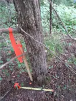
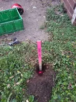
We re-establish missing property corners using wood lath, flags, or paint to clearly define boundaries. This service resolves neighbor disputes, supports fence installation, and aids home remodeling projects. Our team ensures precise location identification with optional iron pipe placement for improved visibility between corners.
New Home Surveys
Our new home surveys provide detailed drawings showing existing conditions and proposed improvements. We collaborate with architects and builders to create base maps, finalize grading plans, and issue official documentation for municipal approvals and construction planning.
ALTA/ACSM Surveys
We conduct ALTA/ACSM Land Title Surveys to meet strict industry standards, identifying easements and title issues for commercial properties. These surveys satisfy lender requirements and include title commitment verification to support real estate transactions and insurance coverage.
Flood Elevation Certificates
Our flood elevation surveys determine base flood elevations and lowest adjacent grades. We prepare FEMA Elevation Certificates to help property owners avoid unnecessary flood insurance requirements by documenting elevation compliance with federal standards.
Topographic Mapping
We create detailed topographic maps showing elevation changes and contour lines at 1-2 foot intervals. These surveys help clients understand drainage patterns and plan property improvements with precise elevation data for construction projects.
People
Mary (Mimi) Wrob
Secretary and Treasurer
Mimi manages office operations and client communications since joining in 2014. Her business expertise and knowledge of local surveying requirements ensure smooth project coordination and exceptional customer service.
Thomas M. Bloom
President and Licensed Surveyor
Tom has been a licensed land surveyor since 2003 with over 35 years of experience. He oversees field data collection, boundary computations, and client communications while maintaining Minnesota license #42379.
Wayne W. Preuhs
Vice President and Licensed Surveyor
Wayne has held Minnesota surveyor license #43503 since 2004. He contributes expertise in boundary resolution and construction staking, combining academic training from St. Cloud State University with practical field experience.
Joshua Rinke
Licensed Civil Engineer
Josh provides engineering services including grading and drainage design. His expertise supports new home construction projects and ensures technical compliance with Minnesota engineering standards under license #52716.
Brady Halvorson
Surveyor
Brady performs land surveys and drafting services since graduating from Dunwoody College of Technology in 2019. His technical skills support field operations and digital mapping requirements for various surveying projects.
Questions
What types of surveys do you offer?
We provide property boundary surveys, ALTA/ACSM title surveys, flood elevation certificates, topographic mapping, new home surveys, and specialty staking services.
How quickly can you complete a survey?
We prioritize urgent projects and will adjust schedules to meet critical deadlines while maintaining accuracy and quality standards.
Do you provide cost estimates?
Yes, we offer free proposals with fixed pricing and completion timelines before starting any survey work.
Are your surveyors licensed?
All our surveyors hold active Minnesota licenses, including Tom Bloom (#42379) and Wayne Preuhs (#43503).
Do you serve commercial clients?
Yes, we provide ALTA/ACSM surveys and boundary resolutions for commercial properties with title insurance requirements.
Can you help with property divisions?
We prepare property division surveys and plat documents for lot splits, working with local municipalities to ensure regulatory compliance.