Business Details
43 Years
experience
Professional Land Surveying Services in Vancouver, WA
Minister & Glaeser Surveying has delivered high-quality surveying services since 1983, specializing in boundary, topographic, hydrographic, and construction surveys. Our team of licensed professionals prioritizes safety, accuracy, and client collaboration, serving private and public sector clients across the Pacific Northwest. With decades of combined experience, we utilize advanced technology to ensure projects are completed efficiently, on schedule, and within budget.Our principals hold licenses in multiple states and have managed complex projects, including light rail systems and federal contracts. We maintain strong client relationships and have received commendations for our performance on critical surveying assignments.
Services
Boundary Surveys
Hydrographic Surveys
ALTA Surveys
Construction Staking
Topographic Mapping
Geodetic Control
Digital Terrain Modeling
FEMA Flood Certificates
Details
- Year established: 1983
Highlights and features
- We have over 40 years of experience in Pacific Northwest surveying projects.
- Our team includes licensed surveyors in six western U.S. states.
- We maintain a proven track record of on-time, on-budget project delivery.
- Our principals have managed complex infrastructure projects like light rail systems.
- We utilize advanced GPS and CAD technologies for survey accuracy.
Services
Boundary Surveys
We conduct precise boundary surveys to establish property lines using historical records and modern technology. Our licensed surveyors resolve disputes and ensure compliance with state regulations. Clients rely on our expertise for residential, commercial, and federal projects.
Hydrographic Surveys
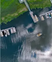
Our hydrographic surveys map underwater terrain for dredging, floodplain management, and environmental projects. We use sonar and GPS technology to collect accurate bathymetric data. This supports infrastructure planning and water resource management across the Pacific Northwest.
ALTA Surveys
We perform ALTA/ACSM surveys meeting national standards for commercial property transactions. Our detailed maps identify easements, improvements, and encroachments. Title companies and lenders trust our surveys for risk assessment in real estate deals.
Construction Staking
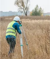
Our construction staking services guide infrastructure projects with precise elevation and alignment markers. We support roadways, utilities, and buildings using robotic total stations. Contractors depend on our work to maintain design specifications during construction.
Topographic Mapping
We create detailed topographic maps showing natural and man-made features. Our surveys support engineering design, land development, and environmental assessments. Clients receive accurate elevation models and contour data for project planning.
People
Edmund Denny
Principal, Project Manager
Professional Land Surveyor with 32 years of experience managing complex projects. Licensed in four states, he specializes in construction surveys and CAD software applications.
Daniel Renton
Principal, Project Manager
Licensed surveyor with 20 years of expertise in GPS methods and school construction projects. Holds certifications in multiple western U.S. states.
David Denny
Principal, Project Manager
31-year veteran surveyor specializing in boundary research and legal descriptions. Licensed in Washington and Oregon, with extensive field experience.
Kevin Bethje
Principal, Project Manager
18-year surveying professional managing control surveys and mapping projects. Licensed in four states, with expertise in digital terrain modeling software.
Questions
What surveying services do you offer?
We provide boundary surveys, ALTA/ACSM standards, hydrographic surveys, construction staking, topographic mapping, and geodetic control across the Pacific Northwest.
Which states do you serve?
We operate in Washington, Oregon, Idaho, Montana, and Arizona, with offices in Vancouver and Pasco, Washington.
How experienced is your team?
Our principals have 18-32 years of experience, with licenses in six western states and expertise in complex infrastructure projects.
What technologies do you use?
We employ GPS RTK, robotic total stations, AutoCAD Civil 3D, and digital terrain modeling software for accurate survey results.
Can you handle federal projects?
Yes, we hold certifications including Certified Federal Surveyor #1192 and have completed contracts for federal agencies.