
Business Details
18 Years
experience
Professional Land Surveying Services in Portland, OR
Summit Land Surveyors has been delivering precise and innovative surveying solutions in Portland and Northwest Oregon since 2008. Founded by John Wade and Cory Montgomery, our firm combines over 49 years of combined experience in field and office surveying to serve homeowners, real estate agents, attorneys, and developers. We specialize in boundary surveys, topographic mapping, and construction layout while maintaining hands-on owner involvement for every project.Our commitment to cutting-edge technology ensures cost-effective results without compromising accuracy. By limiting our workload, we guarantee each client receives personalized attention to meet project timelines and budgets. Our team's expertise in ALTA/NSPS standards and FEMA elevation certifications sets us apart in the Pacific Northwest surveying industry.

Services
Boundary Surveys
Topographic Mapping
Construction Layout
ALTA/NSPS Surveys
FEMA Elevation Certificates
Legal Descriptions
Subdivision Plats
Mortgage Surveys
Details
- Year established: 2008
Highlights and features
- We have over 15 years of combined experience in Pacific Northwest surveying
- Our owners maintain hands-on involvement in every project
- We utilize the latest surveying technology for accurate results
- We limit workload to ensure personalized attention for each client
- Our team includes registered Professional Land Surveyors in Oregon
Services
Boundary Surveys
Our boundary surveys establish precise property lines using historical records and modern technology. We research deeds, locate monuments, and resolve encroachments for residential and commercial properties. Clients receive detailed maps and documentation for legal protection and development planning.
Topographic Mapping
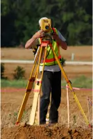
We create detailed topographic maps showing natural and man-made features. Using total stations and GPS equipment, we capture elevation data for site planning and engineering design. Our maps meet ALTA/NSPS standards for accuracy and detail.
Construction Layout
Our construction surveys ensure accurate building placement and grading. We stake foundations, utilities, and infrastructure to match design plans. Regular verification checks maintain dimensional accuracy throughout the construction process.
ALTA/NSPS Surveys
We perform ALTA/NSPS land title surveys meeting national standards. These comprehensive surveys identify easements, improvements, and boundary conflicts for commercial transactions. Clients receive detailed reports for title insurance purposes.
FEMA Elevation Certificates
Our elevation certificates document building elevations for floodplain management. We measure structures relative to flood insurance rate maps to determine risk levels. These certificates help clients obtain accurate flood insurance rates.
People
John Wade
Co-Owner / Director of Surveying
John Wade has 27 years of surveying experience and is a registered Professional Land Surveyor in Oregon. He previously worked with a national design firm before co-founding Summit Land Surveyors in 2008. His expertise spans field operations to project management.
Cory Montgomery
Co-Owner
Cory Montgomery brings 22 years of surveying and engineering experience to Summit Land Surveyors. He specializes in commercial and residential development projects with expertise in interdisciplinary coordination and technical problem-solving for complex developments.
Questions
What surveying services do you offer?
We provide boundary surveys, topographic mapping, construction layout, ALTA/NSPS surveys, FEMA elevation certificates, legal descriptions, subdivision plats, and mortgage surveys.
How are survey costs determined?
Survey costs depend on project complexity, required research, and coordination with engineers, planners, and title companies. We provide detailed estimates after evaluating your specific needs.
Why is a title report important for surveys?
A title report reveals easements and property rights that affect boundary determinations. We need vesting deeds for your property and adjacent parcels to accurately resolve boundaries.
What equipment do you use?
We use total stations, GPS systems, and robotic instruments for precise measurements. Our technology enables efficient data collection and integration with digital mapping systems for accurate results.
How long have you served the Pacific Northwest?
Summit Land Surveyors has provided services in Portland and Northwest Oregon since 2008, with our team having over 49 combined years of regional surveying experience.