
Business Details
22 Years
experience
Expert Land Surveying & Geospatial Mapping Services
Founded in 2004 by Jacob Carroll, Bearing Tree Land Surveying has established itself as a leader in advanced land surveying and geospatial mapping solutions. Our expertise in aerial LiDAR, mobile mapping, and 3D laser scanning technologies enables us to deliver unparalleled accuracy and efficiency to clients across the United States. With over two decades of combined experience, our team of licensed professionals prioritizes direct client engagement, ensuring hands-on service from project inception to completion. We maintain rigorous quality control through field verification and in-house data processing, setting industry benchmarks for precision. Our commitment to innovation has driven successful projects for transportation infrastructure, energy sectors, and architectural preservation, among others.By strategically remaining small, we offer nimble, focused service without compromising technical excellence. Our principals remain directly accessible to clients, reflecting our belief that exceptional surveying results from expertise, not scale. This philosophy has earned us recognition from professional organizations like the National Society of Land Surveyors and the American Society for Photogrammetry and Remote Sensing. We continuously invest in cutting-edge technologies such as Leica and Bentley software systems to maintain our competitive edge. From highway mapping to complex bridge rehabilitation projects, our work consistently exceeds industry standards while optimizing time and cost efficiency for clients.
Services
3D Laser Scanning
Aerial LiDAR Mapping
Land Surveying
Mobile Mapping
Aerial Imagery
GIS Data Management
Boundary Surveys
Topographic Mapping
As-Built Surveys
Vegetation Analysis
Details
- Year established: 2004
Highlights and features
- We offer 20+ years of specialized experience in LiDAR and photogrammetry technologies
- Our principals maintain direct client contact throughout every project
- We guarantee service quality excellence with field-verified data accuracy
- We provide nationwide coverage with rapid mobilization capabilities
- Our in-house data processing ensures security and fast delivery times
Services
Aerial LiDAR Mapping
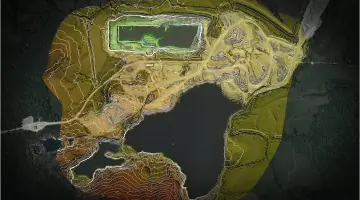
Our Aerial LiDAR Mapping service captures survey-grade data at 2,000,000 measurements per second with sub-centimeter accuracy. Using proprietary aircraft-mounted systems, we create detailed topographic maps for infrastructure and energy projects. This technology enables rapid data collection over large areas while maintaining better than 0.05-foot tolerances.
3D Laser Scanning
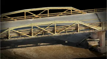
3D Laser Scanning provides precise as-built documentation for architectural and industrial applications. Our Leica RTC360 systems capture millions of data points to create accurate digital twins for bridge rehabilitation and facility management projects. This non-invasive technology reduces field time by 40-60% compared to traditional methods.
Mobile Mapping
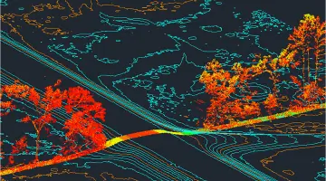
Mobile Mapping systems combine LiDAR, GNSS, and inertial sensors to map roadways at highway speeds. This safe, efficient solution collects corridor data without traffic disruption, ideal for transportation departments needing rapid highway surveys and change detection analysis.
Aerial Imagery
Our manned aircraft capture 1 GSD orthoimagery for precise mapping applications. This service provides high-resolution aerial photos with geospatial metadata, essential for land development projects and environmental monitoring where drone limitations apply.
Boundary Surveys
Boundary Surveys establish legal property lines using historical records and modern measurement techniques. Our licensed surveyors perform title research and physical monumentation to resolve disputes and support real estate transactions across commercial and residential properties.
People
Jacob Carroll
Founder & Licensed Surveyor
Started surveying career in 1996, became youngest licensed surveyor in the U.S. Graduated from Oklahoma State University. Specializes in LiDAR technology implementation and industry education. Served as Oklahoma Society of Land Surveyors president.
Mike Madden
LiDAR Specialist
16+ years experience with LiDAR systems including Leica and Optech. Expert in data acquisition and processing for aerial, terrestrial, and mobile applications. Holds FAA certifications for restricted airspace operations. Developed proprietary workflows for point cloud analysis.
Jonathan Nazari
Geospatial Analyst
13 years at Bearing Tree with expertise in AutoCAD Civil 3D and Terrasolid LiDAR software. Active member of American Society for Photogrammetry and Remote Sensing since 2012. Specializes in DOT projects and infrastructure modeling.
Questions
What surveying technologies does Bearing Tree use?
We utilize aerial LiDAR, 3D laser scanning, mobile mapping systems, and photogrammetry to deliver precise geospatial data for various industries.
Do you provide nationwide surveying services?
Yes, we operate throughout the United States with rapid mobilization capabilities from our Oklahoma City headquarters.
How experienced is your surveying team?
Our principals have over 20 years of combined experience with specialized expertise in LiDAR technology and geospatial analysis.
Can you handle complex infrastructure projects?
We've completed over 100 bridge rehabilitation projects and thousands of highway miles for state transportation departments using advanced mapping technologies.
How quickly can you deliver survey data?
Our in-house processing allows same-day delivery for some projects, with typical turnaround times 30-50% faster than industry averages.
How do you ensure data accuracy?
We combine aerial data collection with ground verification by licensed surveyors to maintain better than 0.05-foot tolerances on all projects.