Business Details
38 Years
experience
Emergency
services
Your Trusted Partner for Geospatial Solutions in Bismarck
Frontier Precision has been a trusted leader in geospatial and surveying services since 1988, serving professionals across surveying, mapping, engineering, construction, and agriculture industries. With over 37 years of experience, we operate 22 offices nationwide, offering Trimble Certified Service Centers and Esri Gold Partner expertise. Our employee-owned company combines cutting-edge technology with certified professionals to deliver precise solutions for land use planning, environmental sciences, and civil engineering projects. We prioritize unmatched customer service, providing tailored consulting, equipment rentals, and certified training programs. Our commitment to innovation ensures clients receive world-class solutions for geospatial data collection, drone operations, and water resource management.With a focus on safety and compliance, we support emergency management, forensic mapping, and invasive plant control applications. Our team of certified pilots and engineers delivers accurate deliverables including point clouds, orthomosaic imagery, and digital surface models. As a fully licensed and insured provider, we offer flexible UAS services for agriculture, mining, and infrastructure projects. Our nationwide footprint and local expertise ensure reliable support for both routine and complex challenges. Trusted by industries from oil and gas to forestry, we remain dedicated to advancing precision technology solutions.
Services
Geospatial Surveying
Drone Operations
Construction Layout
Precision Agriculture
Water Resources
Forensic Mapping
GIS Support
Equipment Rentals
Trimble Training
Invasive Plant Control
Details
- Year established: 1988
Highlights and features
- We have 37+ years of experience in geospatial and surveying services
- Our team includes Trimble Certified technicians and FAA Part 107 pilots
- We operate 22 offices nationwide with local industry expertise
- Our services are backed by Esri Gold Partner certification
- We offer 24/7 technical support for critical infrastructure projects
Associations and certifications
- Trimble Certified Service Center
- Esri Gold Partner
What people say
Expert technical support
Nationwide service network
Certified professionals
Reliable equipment rentals
Comprehensive training
Services
Geospatial Surveying
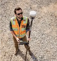
Frontier Precision provides high-accuracy geospatial surveying using GNSS receivers and robotic total stations. Our Trimble-certified technicians deliver precise topographic data for engineering and construction projects. Clients receive detailed deliverables including boundary surveys and elevation models.
Drone Operations
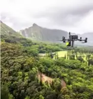
Our FAA-certified pilots operate advanced drones for aerial mapping and LiDAR data collection. Services include photogrammetry, volumetric analysis, and infrastructure inspections. We support agriculture, mining, and public safety applications with customized drone solutions.
Construction Layout
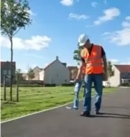
We offer Trimble Building Solutions for construction site layout and verification. Our technology ensures accurate placement of structures using 3D scanning and layout tools. Contractors benefit from reduced rework and improved project timelines through our precision equipment.
Precision Agriculture
Our agricultural solutions combine GPS and drone technology for crop monitoring and field optimization. Farmers receive data-driven insights for planting, nutrient management, and yield improvement. We provide specialized equipment for precision spraying and soil analysis.
Water Resources
We install and maintain remote data acquisition systems for water level and quality monitoring. Our solutions support floodplain management and environmental compliance. Clients receive customized instrumentation packages for surface water and groundwater applications.
People
Dennis Kemmesat
President / Chief Executive Officer
With over 37 years of leadership, Dennis Kemmesat has grown Frontier Precision from a single office to a 22-state operation. He oversees strategic direction and maintains our commitment to geospatial innovation and customer service excellence.
Kevin Hellman
Chief Financial Officer
Kevin Hellman manages financial operations with expertise in scaling technical businesses. He ensures fiscal responsibility while supporting Frontier Precision's expansion of Trimble Certified Service Centers and specialized training programs.
Tyler Bohl
Applied Geospatial Engineer
PLS-certified Tyler Bohl provides technical expertise for complex surveying projects. His 15+ years of experience include developing customized GIS solutions for infrastructure and environmental clients across the western United States.
Collin Kemmesat
Regional Sales Manager
Collin Kemmesat leads Midwest UAS sales with specialized knowledge of agricultural drone applications. He connects clients with tailored unmanned solutions for crop monitoring and precision spraying operations.
Bryer Kaczynski
Service Technician
Bryer Kaczynski specializes in agricultural drone maintenance and repair. His technical skills ensure optimal performance of UAS equipment for farming operations, supporting Frontier Precision's commitment to reliable precision agriculture solutions.
Questions
What geospatial services does Frontier Precision offer?
We provide GNSS surveying, 3D laser scanning, and GIS mapping services using Trimble-certified equipment for land development and infrastructure projects.
Do you offer drone services for agriculture?
Yes, our FAA-certified pilots provide aerial crop monitoring, precision spraying, and yield analysis services using advanced UAS technology.
Are your technicians certified?
All survey technicians hold Trimble certifications, and our drone pilots maintain FAA Part 107 licenses for compliant operations.
What construction technology solutions are available?
We offer Trimble Building Solutions for site layout, concrete scanning, and construction verification with real-time data integration.
Do you serve clients nationwide?
Yes, we operate 22 offices across the US, with specialized support in 18 states from Alaska to Florida.
What water resource monitoring systems do you provide?
We install remote data acquisition systems for water level, quality, and flow monitoring with customized sensor configurations.