
Business Details
Emergency
services
Your Trusted Partner for Geospatial Solutions
At Surveying & Mapping, we deliver fast, accurate geospatial data to empower clients to make confident decisions for their infrastructure and development programs. With decades of experience in mapping, surveying, and data solutions, our team leverages cutting-edge technologies to provide foundational insights for projects ranging from local route surveying to multibillion-dollar infrastructure initiatives. Our commitment to innovation is matched by our dedication to fostering a culture of collaboration, inclusion, and technological advancement. We specialize in land surveying, aerial mapping, GIS consulting, subsurface utility engineering, and powerline inspection, ensuring precision and compliance across diverse industries. Recognized nationally for excellence, including rankings on ENR's Top 500 Design Firms list, we combine national reach with localized expertise to deploy teams within 24 hours.Our strategic focus on digital twins, BIM, and LiDAR technologies positions us as leaders in transforming raw data into actionable intelligence. Clients trust our ISO-certified methodologies and proven track record in managing complex projects for utilities, transportation, government, and natural resource sectors. We prioritize safety, sustainability, and client satisfaction, offering tailored solutions that address both current challenges and future needs. Our affiliations with industry organizations and investments in employee development underscore our mission to drive progress through geospatial excellence.
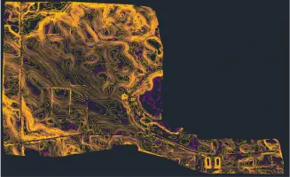

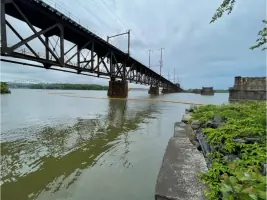
Services
Land Surveying
Aerial Mapping
GIS Consulting
Subsurface Utility Engineering
Powerline Inspection
BIM/3D Laser Scanning
Damage Prevention
Digital Twins
Highlights and features
- We deploy teams within 24 hours for urgent geospatial projects.
- Our experts use LiDAR, BIM, and GIS for precision data collection.
- Recognized nationally on ENR's Top 500 Design Firms list.
- Specialized in utility coordination and powerline inspection compliance.
- We combine 13+ years of industry recognition with local expertise.
What people say
Fast deployment
Accurate data
Expert team
Advanced technology
Services
Land Surveying
Our land surveying services utilize advanced GPS and LiDAR technologies to deliver precise boundary, topographic, and construction surveys. Clients rely on our data for infrastructure planning, property development, and legal documentation. With rapid deployment capabilities, we ensure accuracy and compliance for projects of all scales.
Aerial Mapping
Aerial mapping combines high-resolution drone imagery with geospatial analytics to create detailed 3D models and orthomaps. This service supports transportation planning, environmental monitoring, and asset management. Our FAA-certified pilots and cutting-edge sensors ensure safe, efficient data collection for complex terrains.
GIS Consulting
GIS consulting transforms raw geospatial data into actionable insights for utilities, government agencies, and developers. We specialize in substation digital twins, route optimization, and public safety mapping. Our solutions integrate with enterprise systems to enhance decision-making and long-term planning.
Subsurface Utility Engineering
Subsurface utility engineering identifies and maps underground infrastructure using ground-penetrating radar and electromagnetic detection. This service minimizes risks during construction projects by ensuring accurate utility location and coordination, complying with SUE standards.
Powerline Inspection
Our powerline inspection service employs aerial LiDAR and thermal imaging to assess transmission line integrity. Designed for electric utilities, this solution identifies vegetation encroachment, equipment wear, and storm damage, ensuring compliance with FAC-008 reliability standards.
People
Matthew Reinhart
Mid-East Director of Transportation
Matthew Reinhart, P.E., brings extensive transportation engineering expertise to Surveying & Mapping, specializing in infrastructure planning and project management. With a focus on highway and rail systems, he leads initiatives to enhance mobility and safety across the Mid-East region.
Questions
What industries does SAM serve?
SAM supports utilities, transportation, government agencies, and natural resource sectors with geospatial data solutions.
How quickly can SAM deploy teams?
Our teams deploy within 24 hours to start data collection for urgent projects nationwide.
What technologies does SAM use?
We use LiDAR, drones, BIM, GIS, and subsurface radar for precise geospatial data collection.
Is SAM available for emergency projects?
Yes, we offer rapid response services for infrastructure emergencies and disaster recovery.
Does SAM work on federal projects?
Yes, we collaborate with federal agencies on transportation, energy, and public safety initiatives.
How does SAM ensure data accuracy?
Our ISO-certified processes and advanced technologies guarantee precise, actionable geospatial insights.