
Business Details
36 Years
experience
Expert Land Surveying & Mapping Services
Gorrondona & Associates, Inc. (G&AI) has been a trusted leader in professional land surveying since 1990, delivering innovative solutions across Texas and neighboring states. Our expertise spans advanced technologies like Mobile LiDAR, Aerial Mapping, and Geographic Information Systems (GIS), serving diverse sectors including transportation, energy, and government. With a team of 11 registered land surveyors, certified photogrammetrists, and 20 field crews, we combine cutting-edge tools with decades of experience to ensure precision and reliability.Founded by Brad Gorrondona, a licensed surveyor with over 38 years in the field, our culture prioritizes client satisfaction, operational efficiency, and adherence to the highest industry standards. Our proven track record in complex projects, from municipal infrastructure to oil and gas developments, underscores our commitment to exceeding expectations while maintaining transparency and ethical practices.
Services
Land Surveying
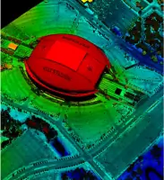
Mobile LiDAR
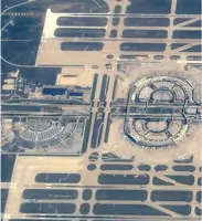
Aerial Mapping
Terrestrial Scanning
Unmanned Aerial Systems
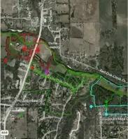
Geographic Information Systems
Geotechnical Engineering
CMT Services
Details
- Year established: 1990
Highlights and features
- 35+ years of experience in professional land surveying.
- Advanced technology including Mobile LiDAR and UAS mapping.
- ASPRS-certified photogrammetrists and licensed surveyors.
- Proven success in complex projects across 210 Texas counties.
- Client-focused approach with on-time, within-budget delivery.
Associations and certifications
- ASPRS (American Society of Photogrammetry and Remote Sensing)
- TxDOT PreCertified
What people say
Excellent survey data
Very responsive
Superior survey product
Consistent and reliable
Adhered to specifications
Services
Land Surveying
Gorrondona & Associates provides comprehensive land surveying services, including boundary, topographic, and construction staking surveys. Utilizing GPS and advanced tools, we ensure precision for engineering and development projects. Our team adheres to strict standards, delivering reliable data for infrastructure, commercial, and municipal needs.
Mobile LiDAR
Our Mobile LiDAR services capture high-density point clouds at highway speeds, offering detailed asset inventories and design-grade mapping. This technology enables efficient data collection for transportation corridors and infrastructure projects. Clients benefit from rapid turnaround and unparalleled accuracy in complex environments.
Aerial Mapping
Using drones and photogrammetry, we produce high-resolution orthoimagery and 3D terrain models for engineering and GIS applications. This method supports rapid data acquisition over large areas, ideal for pipeline corridors and transportation networks. Our ASPRS-certified experts ensure deliverables meet rigorous accuracy standards.
Geographic Information Systems
We develop GIS databases to manage spatial data for utilities, municipalities, and infrastructure projects. Our systems integrate LiDAR, aerial, and field data for comprehensive analysis. Customized tools enable clients to visualize, plan, and maintain assets efficiently across diverse industries.
Terrestrial Scanning
Terrestrial laser scanning captures detailed 3D models of structures and hard-to-reach areas, such as bridge substructures. Our Leica RTC360 scanner provides millimeter-level accuracy for as-built documentation. This technology enhances safety and efficiency in engineering and construction projects.
People
Brad J. Gorrondona
President and CEO
With over 38 years in land surveying, Brad founded G&AI in 1990 and leads its strategic growth. A licensed surveyor since 1988, he emphasizes quality control and client service. His expertise spans municipal and commercial projects, and he actively supports community and educational initiatives in Fort Worth.
Truett Wilson
Director of Survey
A licensed surveyor since 1995, Truett oversees project coordination and resource management across G&AI's offices. With 29 years at the firm, he specializes in municipal infrastructure and TxDOT projects. His leadership ensures seamless integration of field and office operations for client satisfaction.
Scott Dunham
LiDAR Geospatial Director
Scott manages geospatial operations, leveraging 26 years of experience in LiDAR and aerial mapping. Certified by ASPRS, he directs TxDOT's digital delivery programs and researches innovative technologies. His work enhances efficiency in large-scale transportation and infrastructure projects.
Chris Abbott
Senior Project Manager
With 22 years in surveying, Chris specializes in TxDOT projects and boundary surveys. A licensed surveyor in Texas and New Mexico, he ensures technical accuracy and client compliance. His experience spans multiple districts, delivering complex projects on time and within budget.
Richard Kennedy
Dallas District Manager
Richard has 46 years of surveying experience, focusing on water infrastructure and TxDOT projects. As Dallas District Manager, he oversees topographic and boundary surveys for municipalities. His deep local knowledge ensures tailored solutions for regional clients.
Questions
What services does Gorrondona & Associates offer?
We provide land surveying, Mobile LiDAR, Aerial Mapping, Terrestrial Scanning, GIS, and geotechnical engineering services for commercial, government, and energy sectors.
How long has Gorrondona & Associates been in business?
Founded in 1990, we have over 35 years of experience delivering surveying and mapping solutions across Texas and neighboring states.
What areas do you serve?
We operate in Texas and extend services to Oklahoma, New Mexico, and Louisiana, with projects in 210 Texas counties.
Are your surveyors certified?
Yes, our team includes 11 registered professional land surveyors and ASPRS-certified photogrammetrists with industry-specific expertise.
What technologies do you use?
We utilize Mobile LiDAR, UAS drones, terrestrial scanners, and GIS software to ensure high-accuracy data collection and analysis.
Can you handle large-scale infrastructure projects?
Yes, we have extensive experience in transportation, energy, and municipal projects, including TxDOT contracts and water infrastructure.